Kanto in Watercolor (Official 1996 Artwork)
Enhanced 1996 Kanto maps
Written by Dr Lava • May 15, 2021
In April 1996, Creatures Inc published Pokemon Red & Green’s first strategy guide, a book called Pokedex. It contained an 8 page interview with Satoshi Tajiri, about 50 pages of lore (translation complete and coming soon), and 26 maps that together comprise the entirety of Kanto’s overworld. I’ve been working to localize various sections of this book, with this page serving as a high-resolution archive of the map section. According to the book’s credits, this artwork was made by either Kyoko Terada or Hidetaka Miyachi.
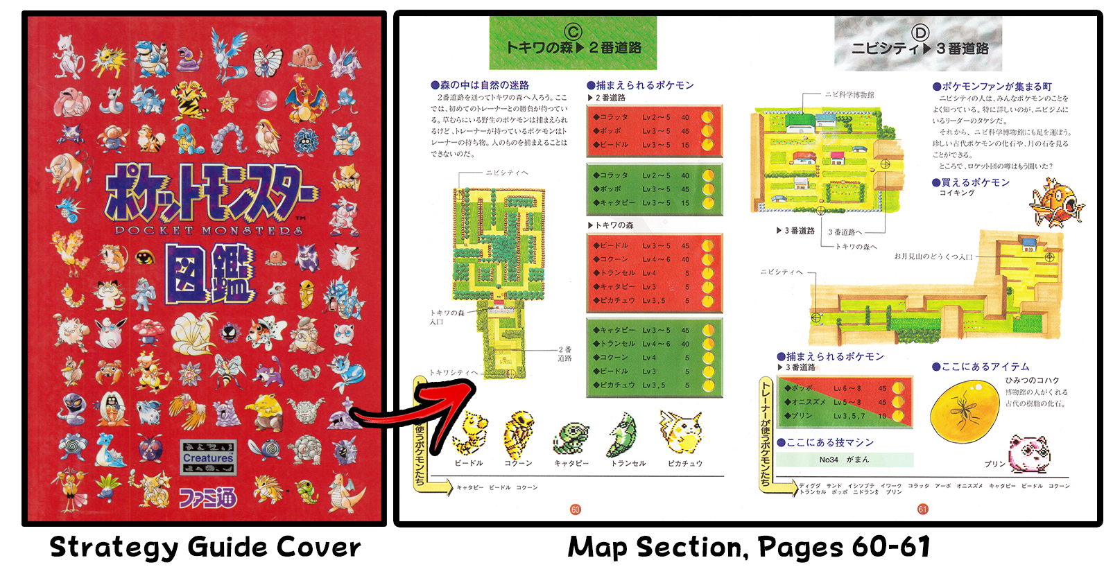
As you can see from the two pages seen above, each map has lines and arrows with labels that identify buildings, route entrances, etc. We bought the book, cut out its pages so they could be laid flat, scanned them in high resolution, and enhanced them. We also digitally removed the lines and arrows, since they’re a bit of an eyesore for art preservation. And by “we,” I mostly mean HiResPokemon, a good friend of mine who specializes in these sorts of projects. If you like rare Pokemon art, definitely follow him on Twitter or Instagram.
All 26 maps are archived here in high resolution. Unfortunately, the maps weren’t printed in high-res in the book itself, because they were only a few inches tall on each page. So if you zoom way in, you’ll notice a little blur. Also, lots of lines aren’t straight — this is because these maps were hand-painted, not due to any scanning errors. If you plan on reposting one these maps somewhere, please link back to this page.

Game Boy Color didn’t release until 1998, so unless they had a Super Game Boy add-on for Super Nintendo, fans were exploring Kanto in black and white. Below you can find all Gen 1’s in-game maps, as well as the corresponding artwork that appeared in the 1996 strategy guide — perhaps what Kanto would have felt like in a fan’s imagination.
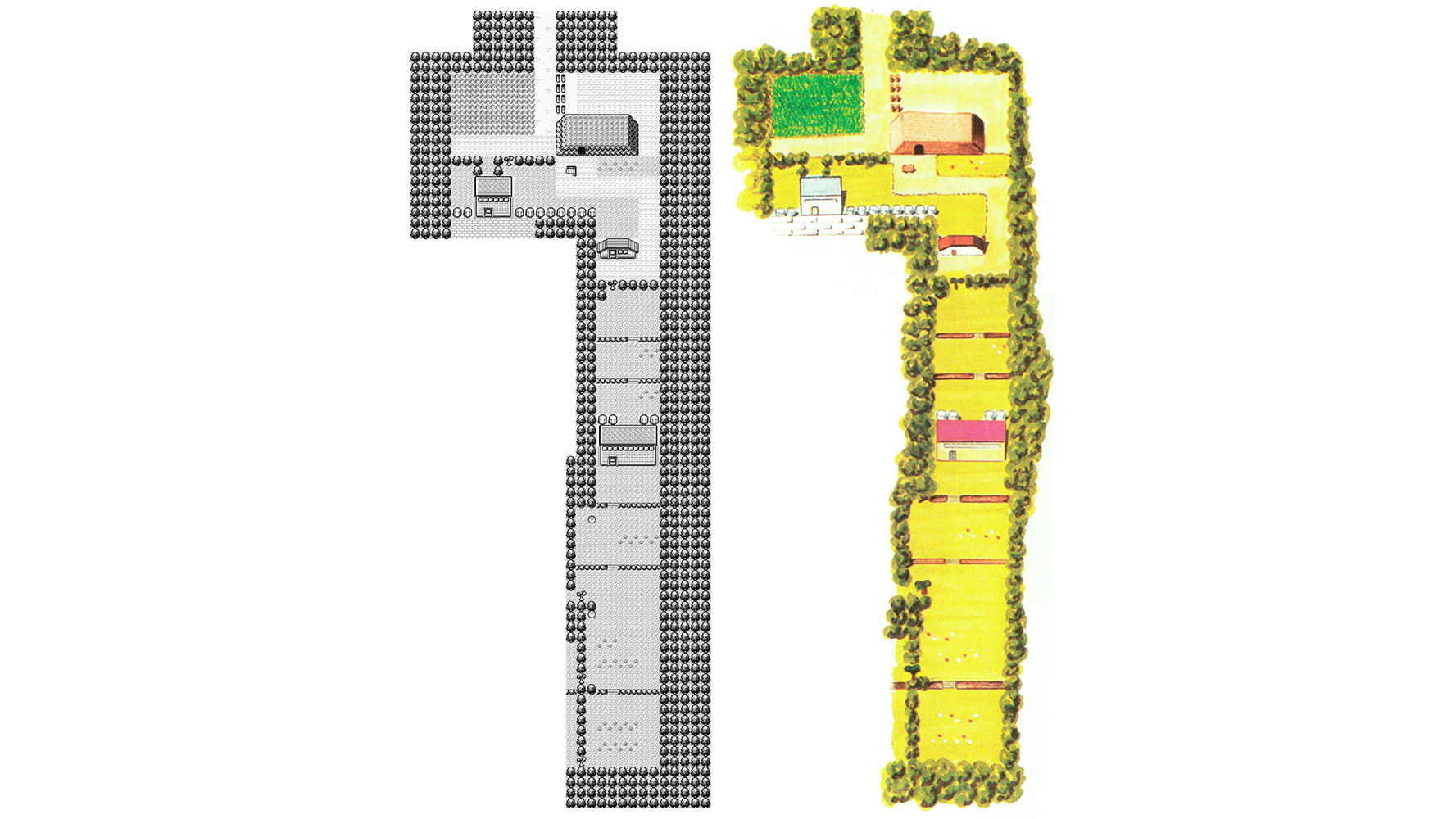
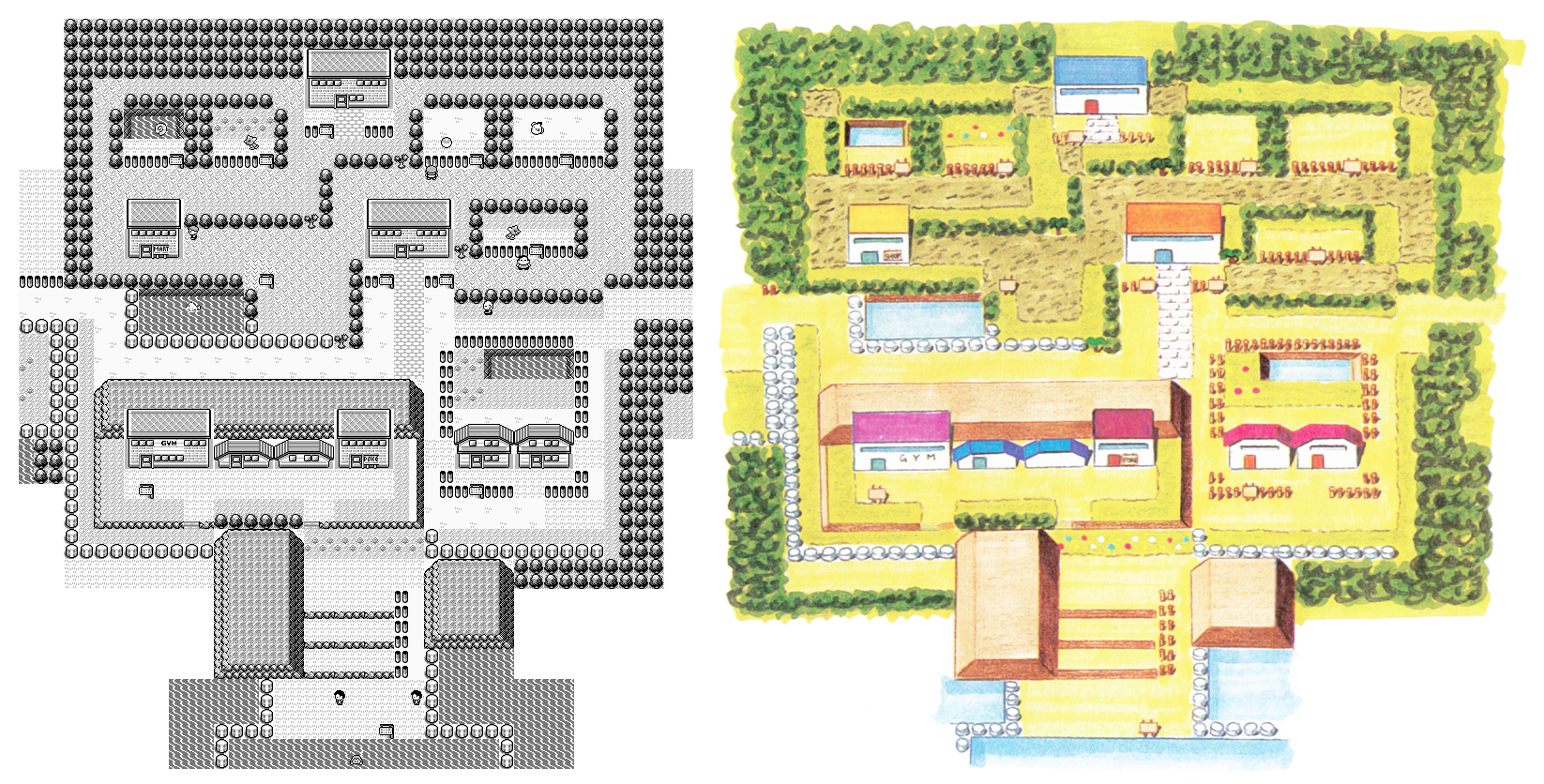
Pallet Town and Route 1
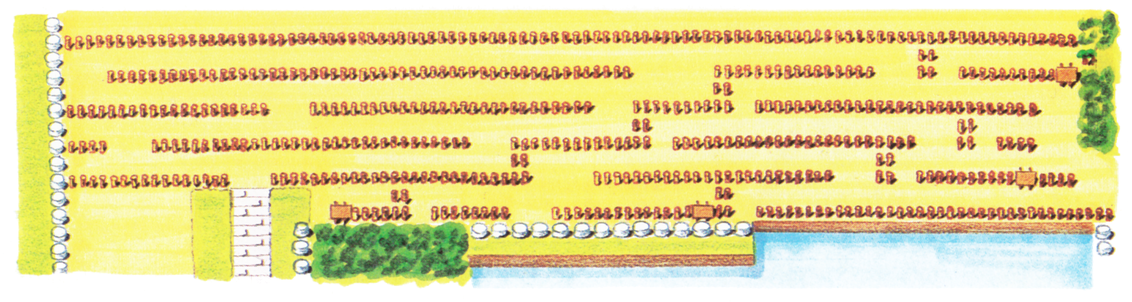
Dr Lava notes: This side-by-side comparison image is condensed — for the full-resolution enhancement, see below. All 26 maps on this page are laid out in this same format: condensed comparison above, full-resolution below. You can click any image to enlarge it or zoom in.
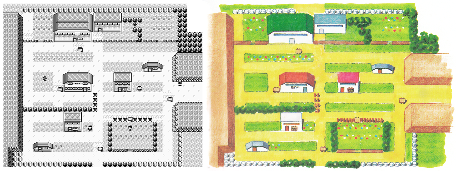
Viridian City and Route 22
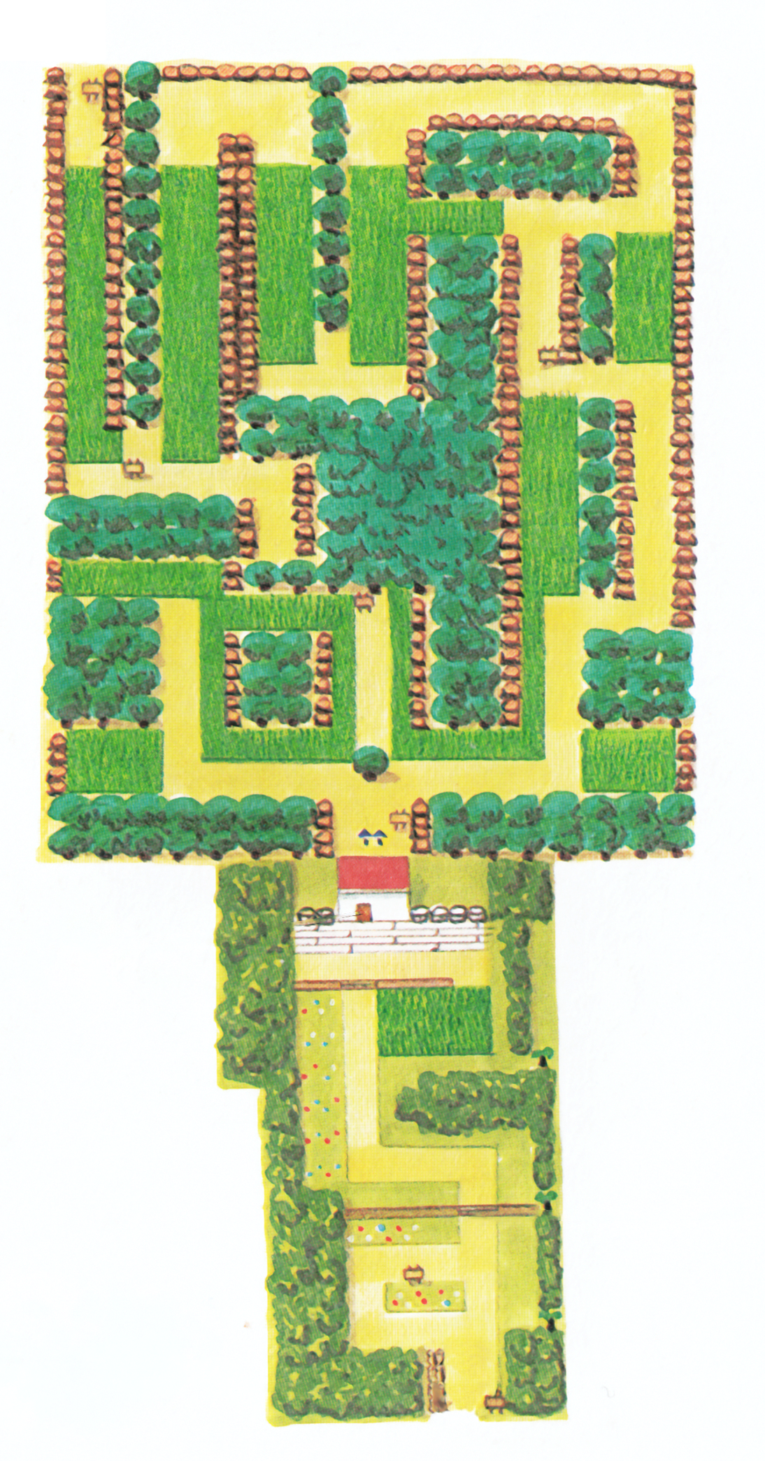
Route 2 and Viridian Forest
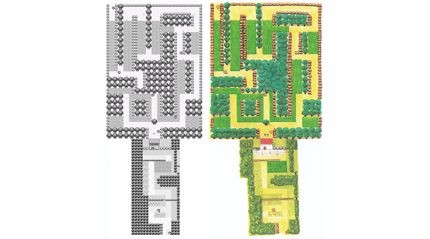
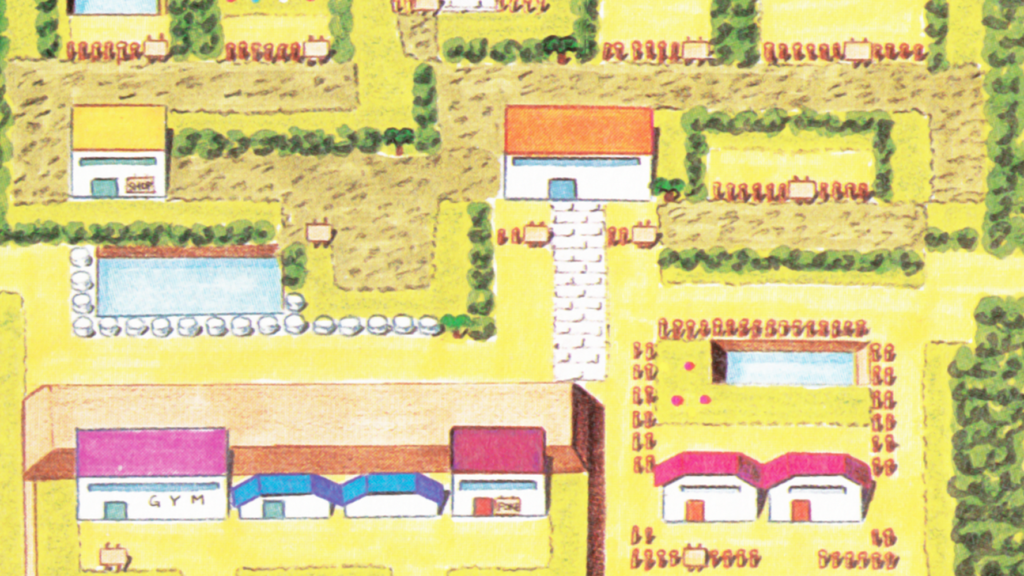
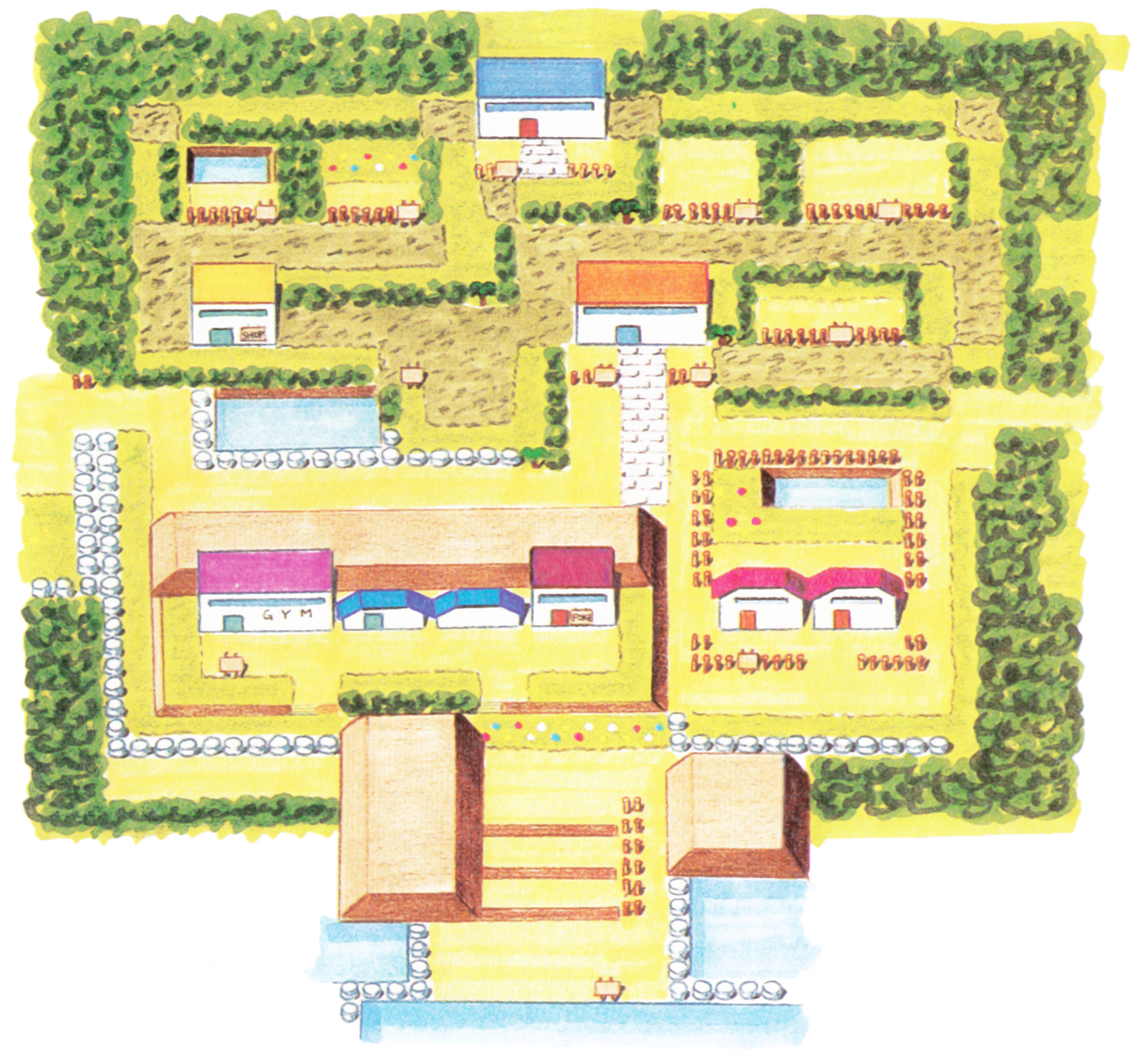
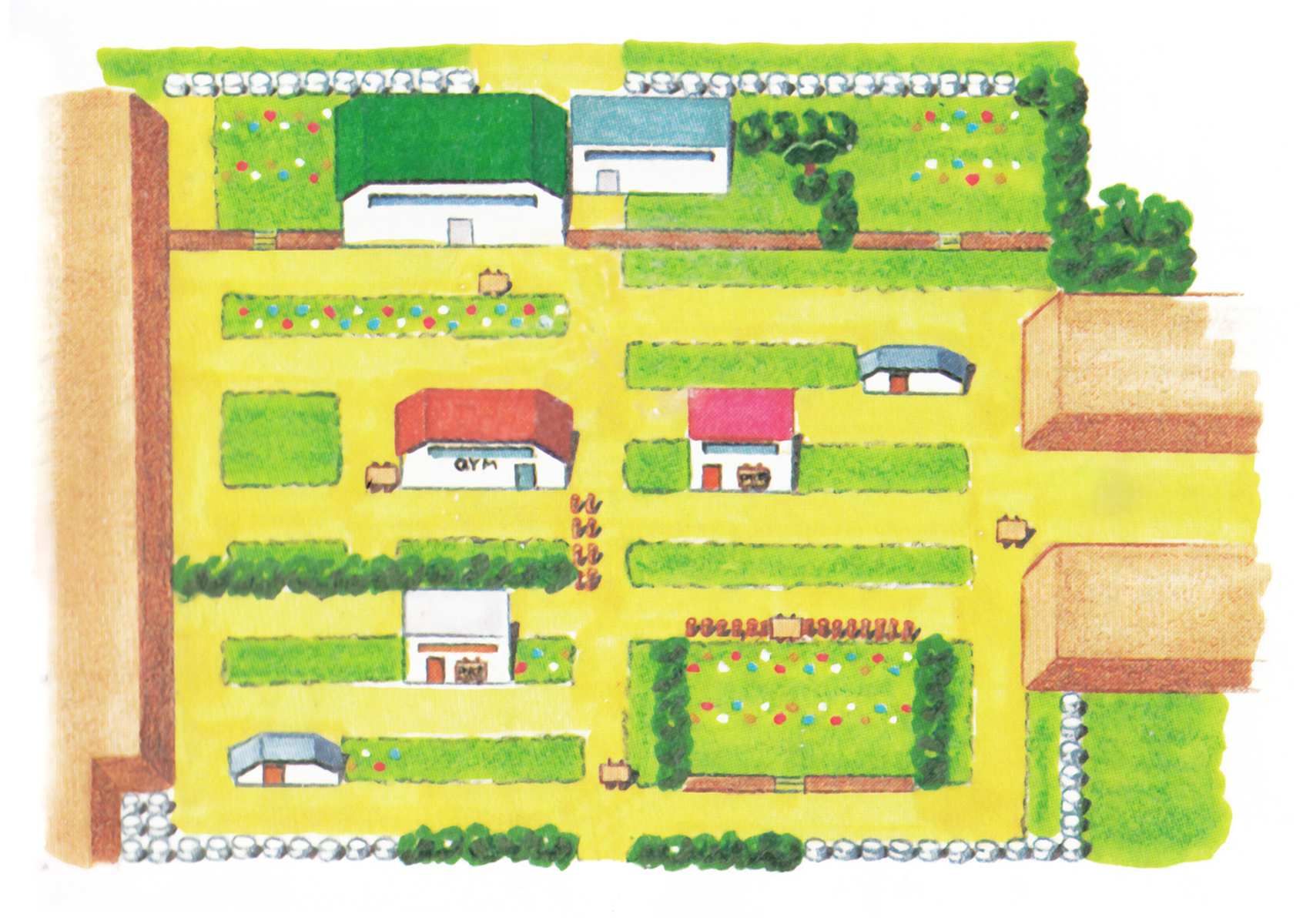
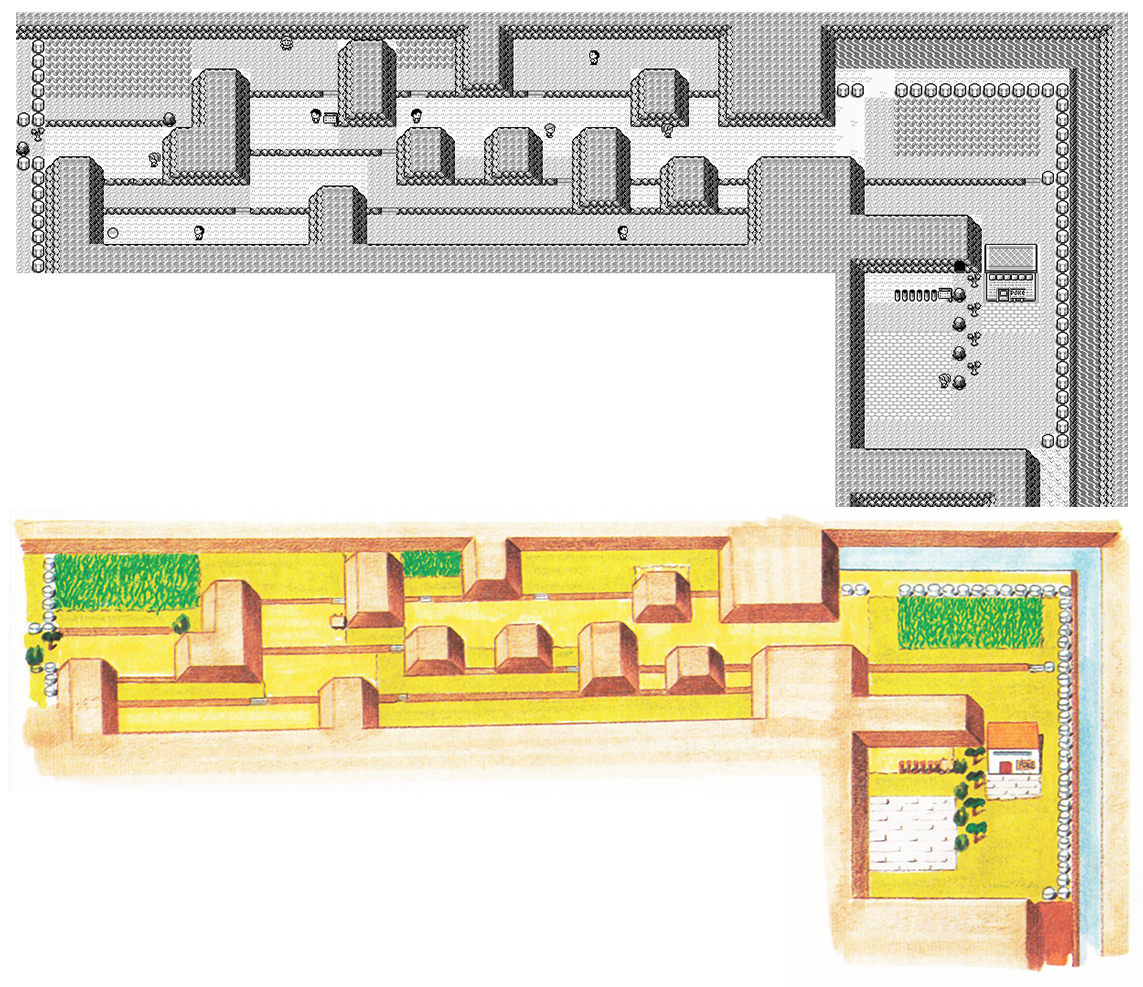
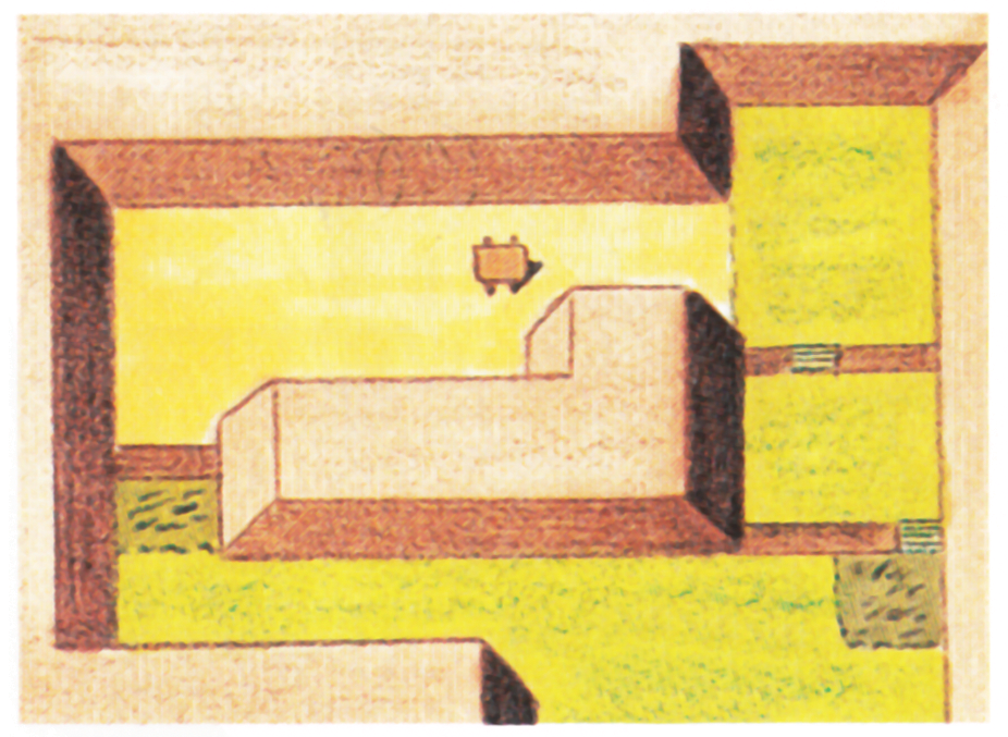
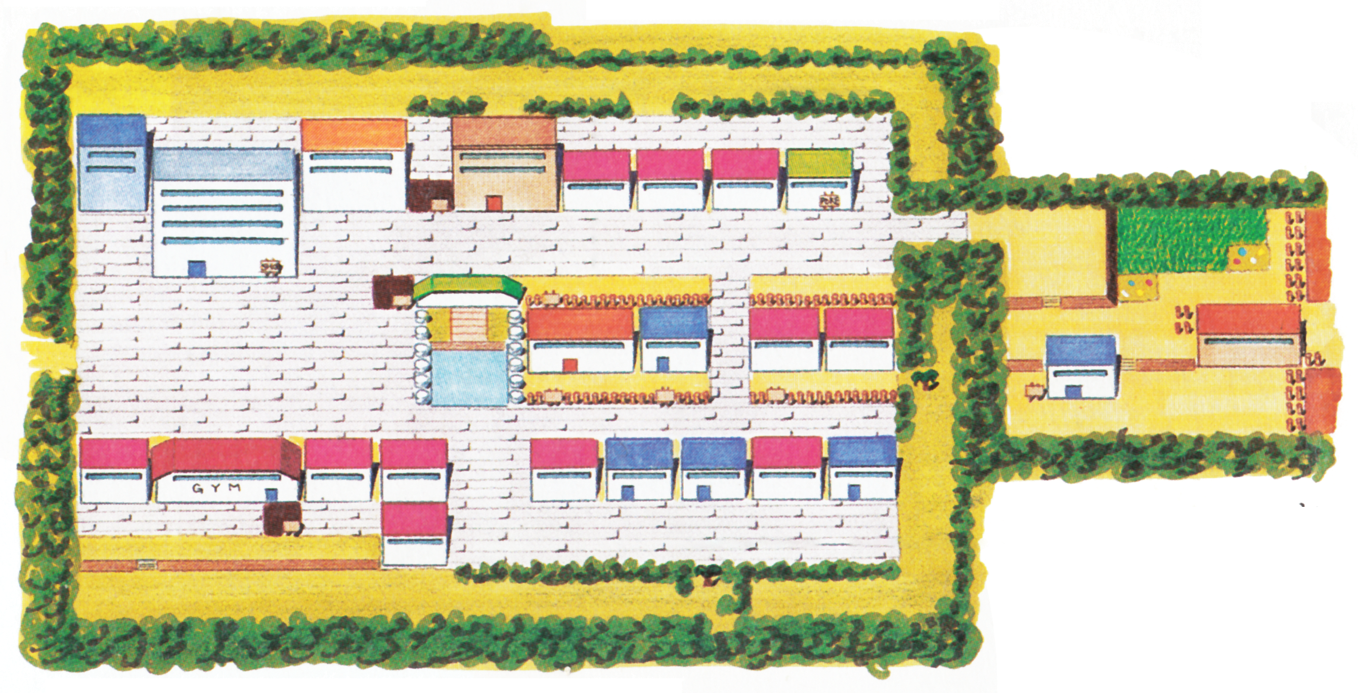
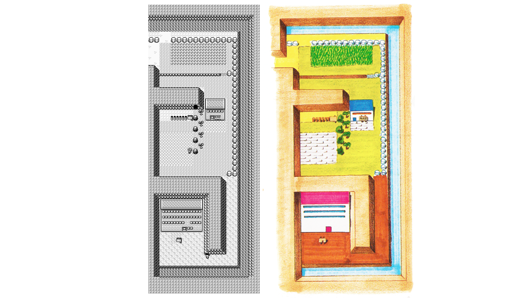
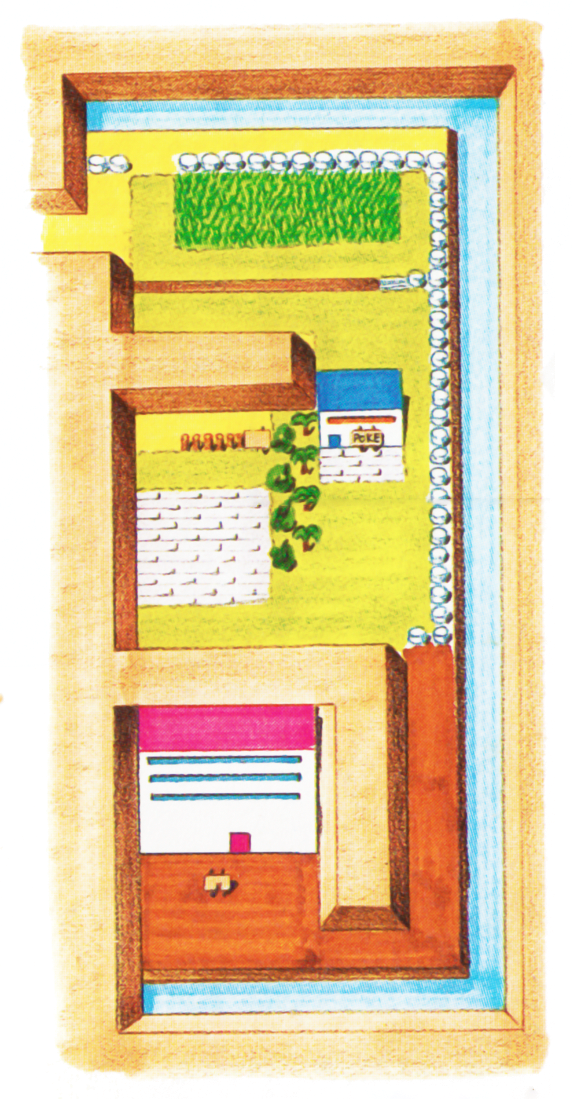
Pewter City
Dr Lava notes: It’s worth pointing out that the artwork has a path behind the museum, while the in-game map is blocked off. In case you’re curious, there’s absolutely nothing up there, even if you use cheats or hacks.
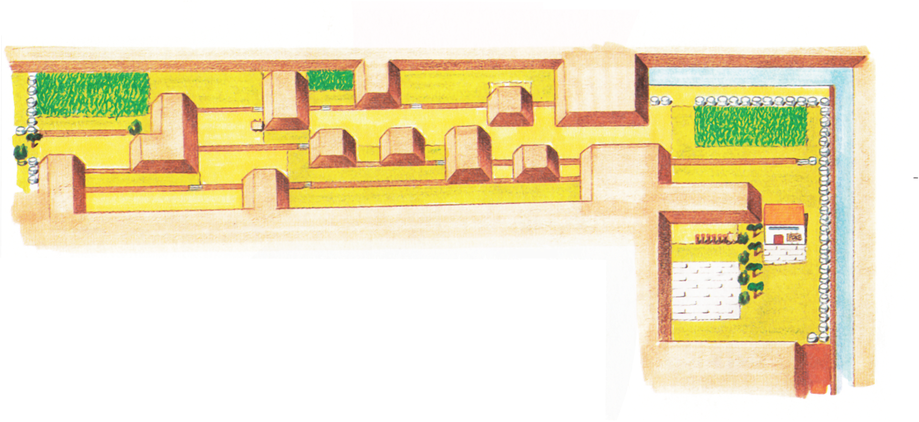
Routes 3 and 4
Route 4
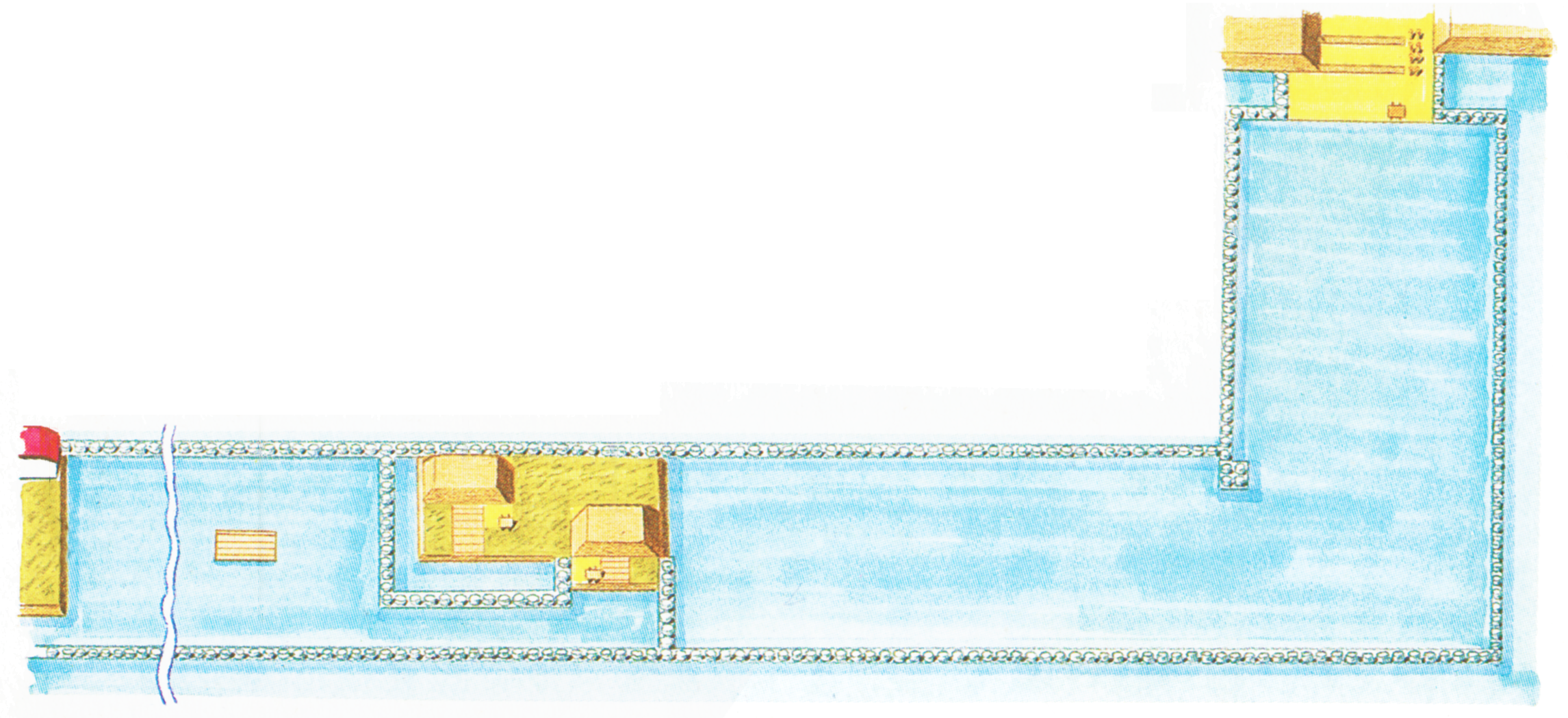
Dr Lava notes: A few of these maps are so wide that it makes more sense for the comparison images to be on top of each other, rather than side-by-side. Just keep in mind, the comparison images are all compressed, and the artwork below are all full-resolution.
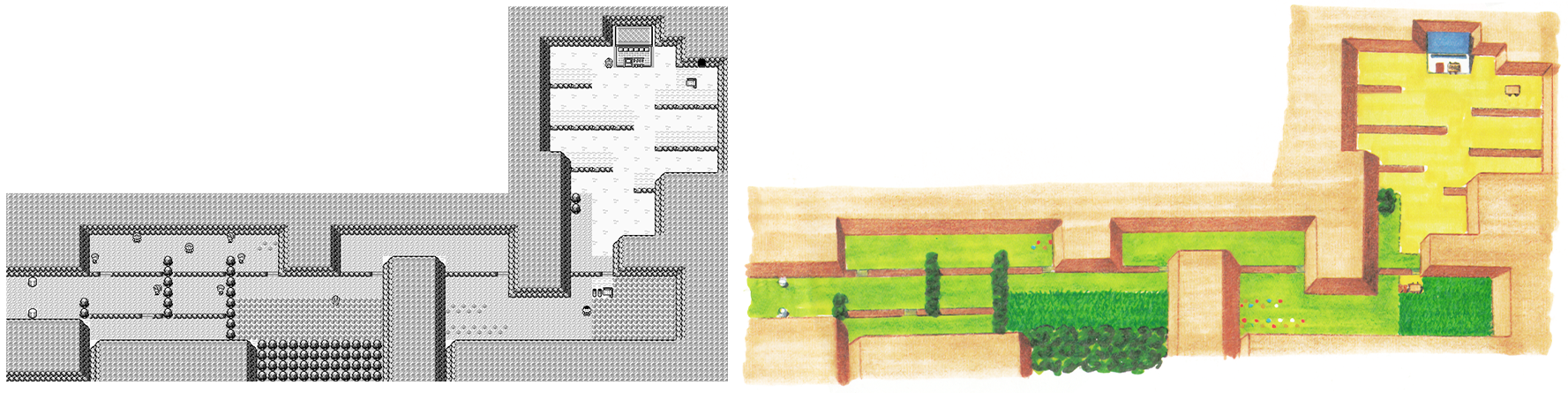
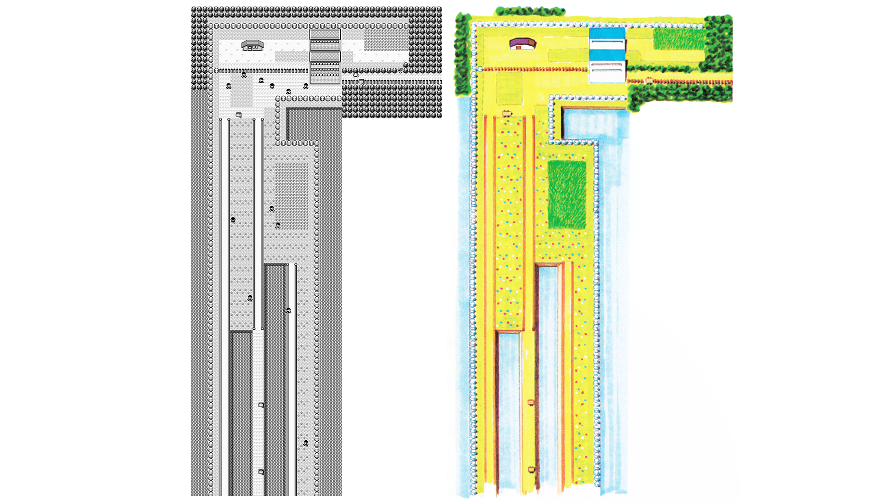
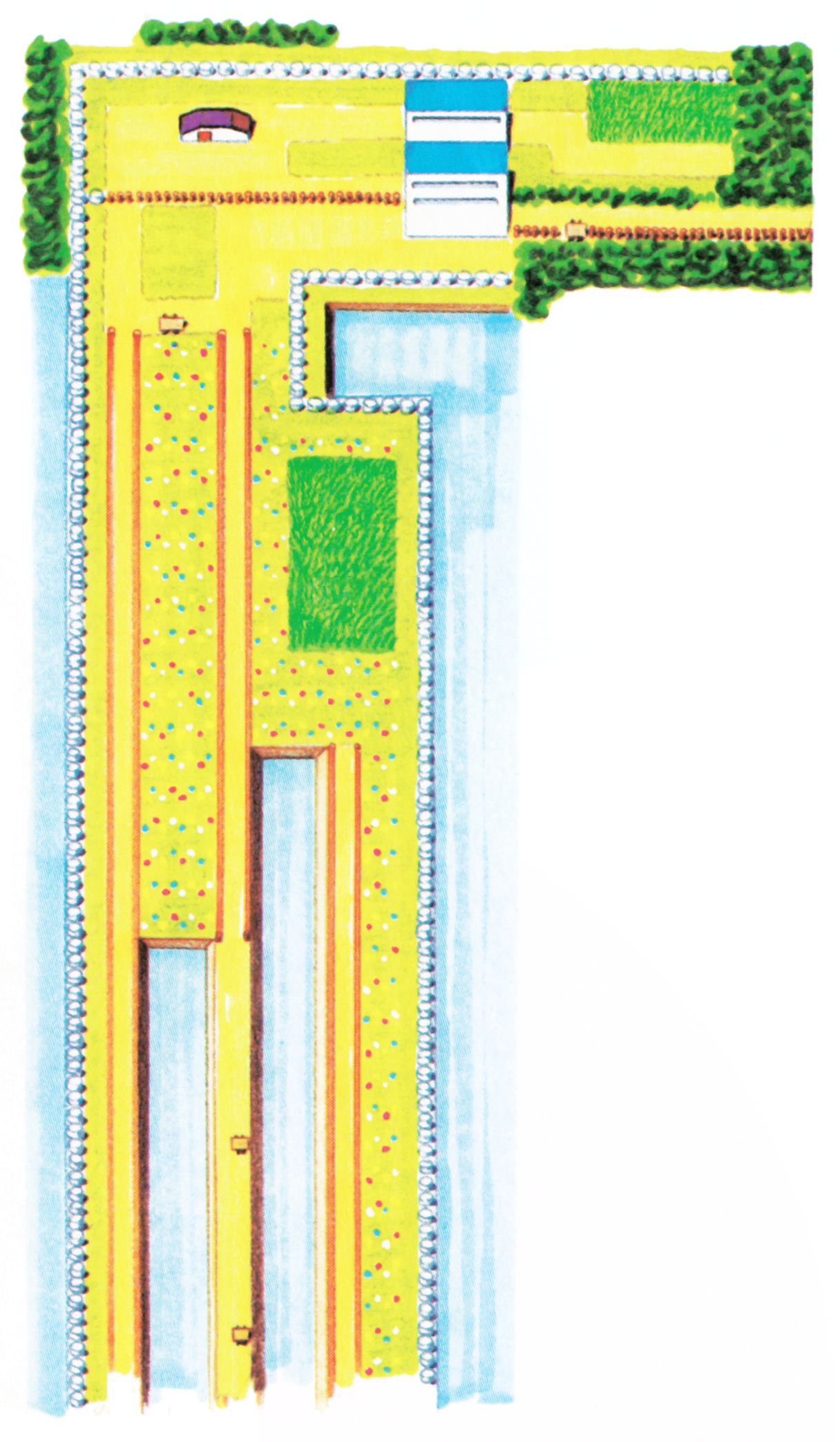
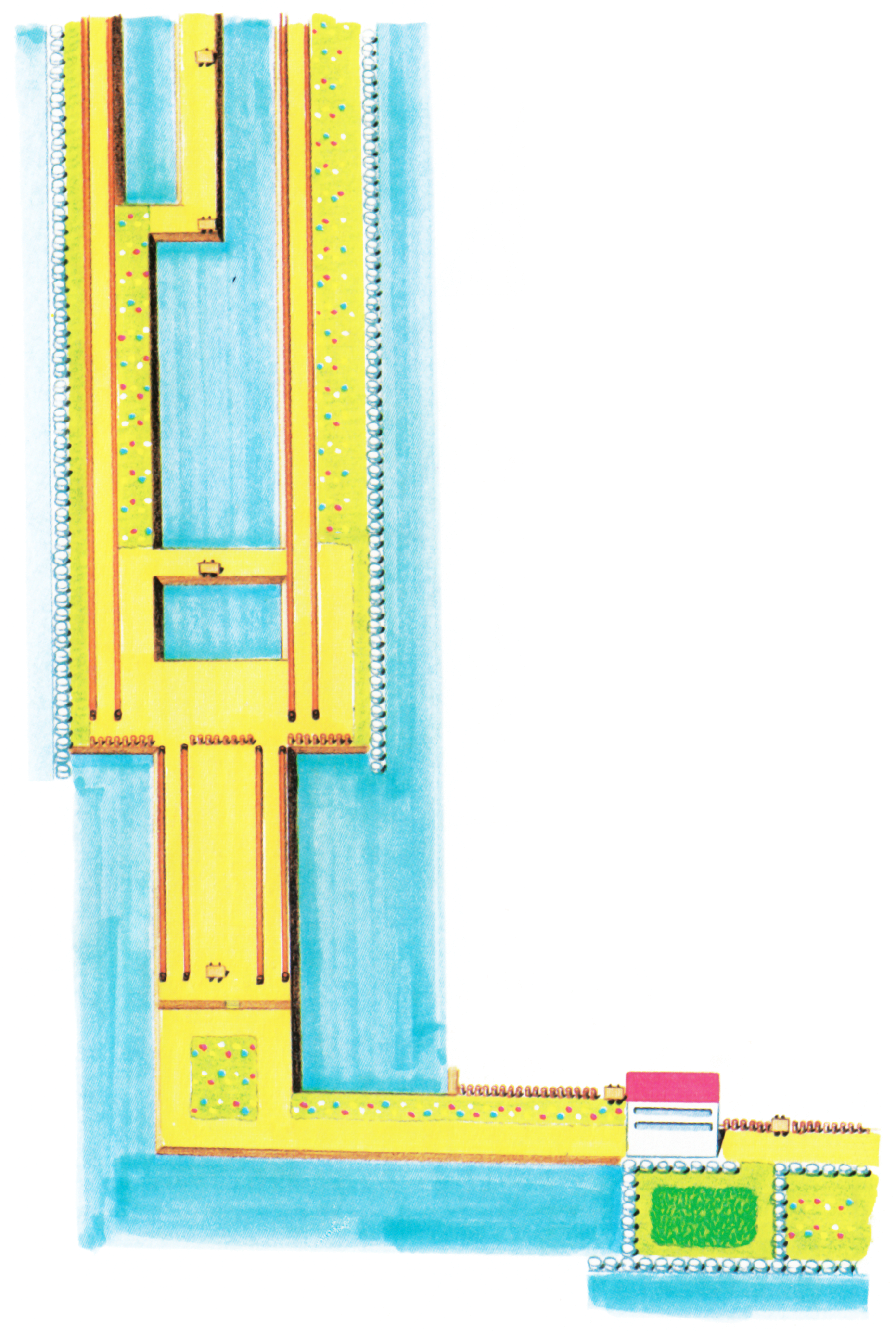
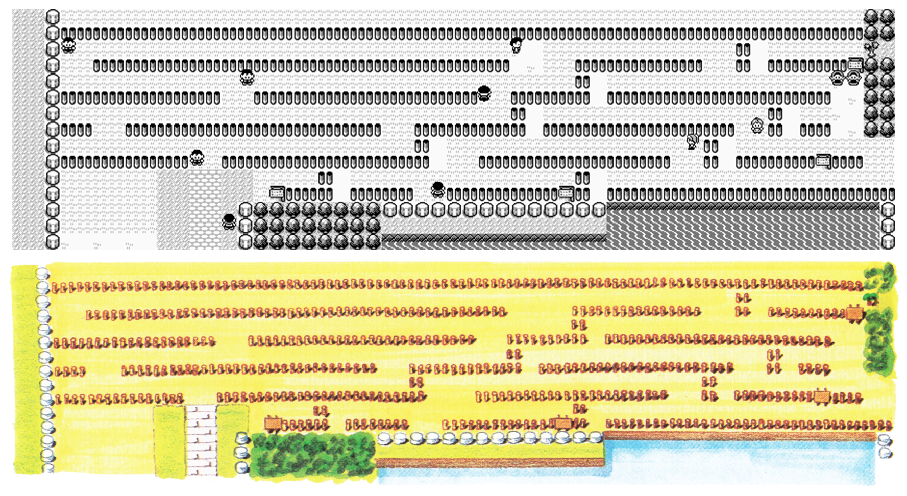
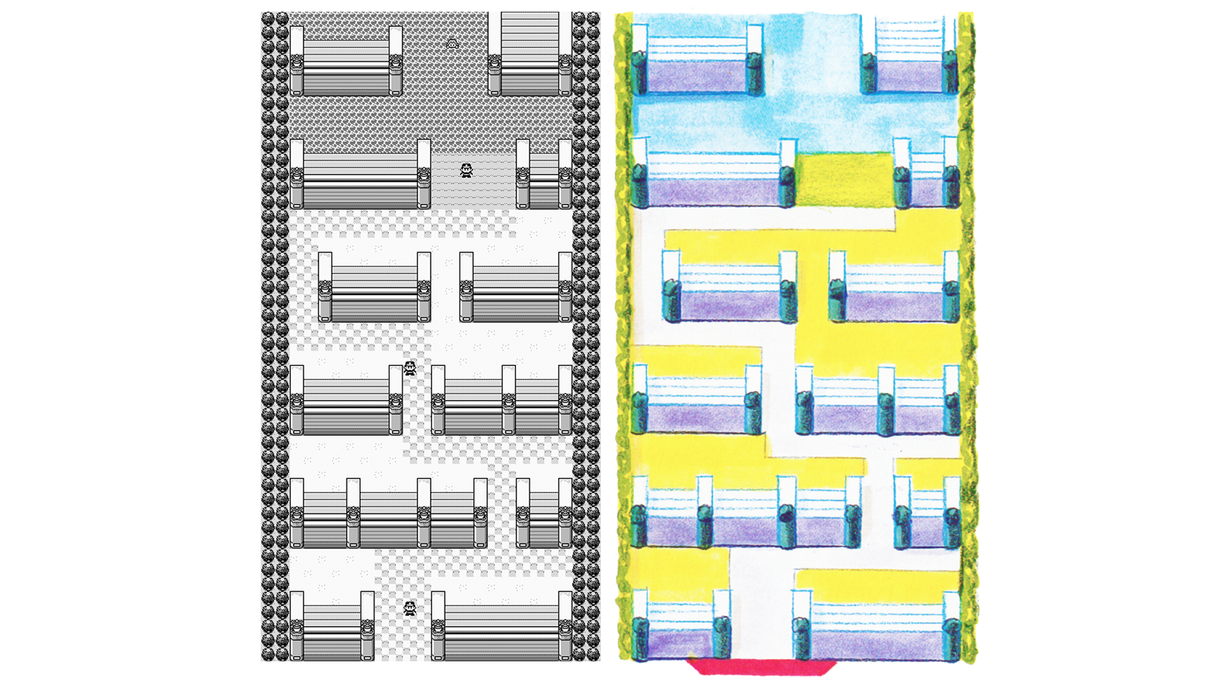
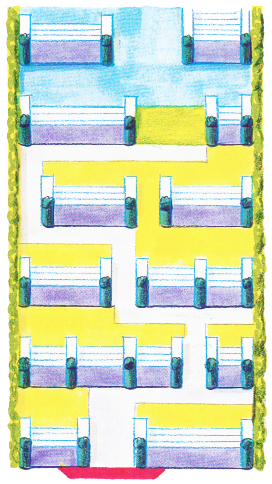
Cerulean City, Routes 5, 24, and 25
Dr Lava notes: For some reason, none of these watercolor maps show any cave entrances. But it’s also worth noting that on this particular map, the tiny strip of land that’s home to the Unknown Dungeon is conspicuously missing.
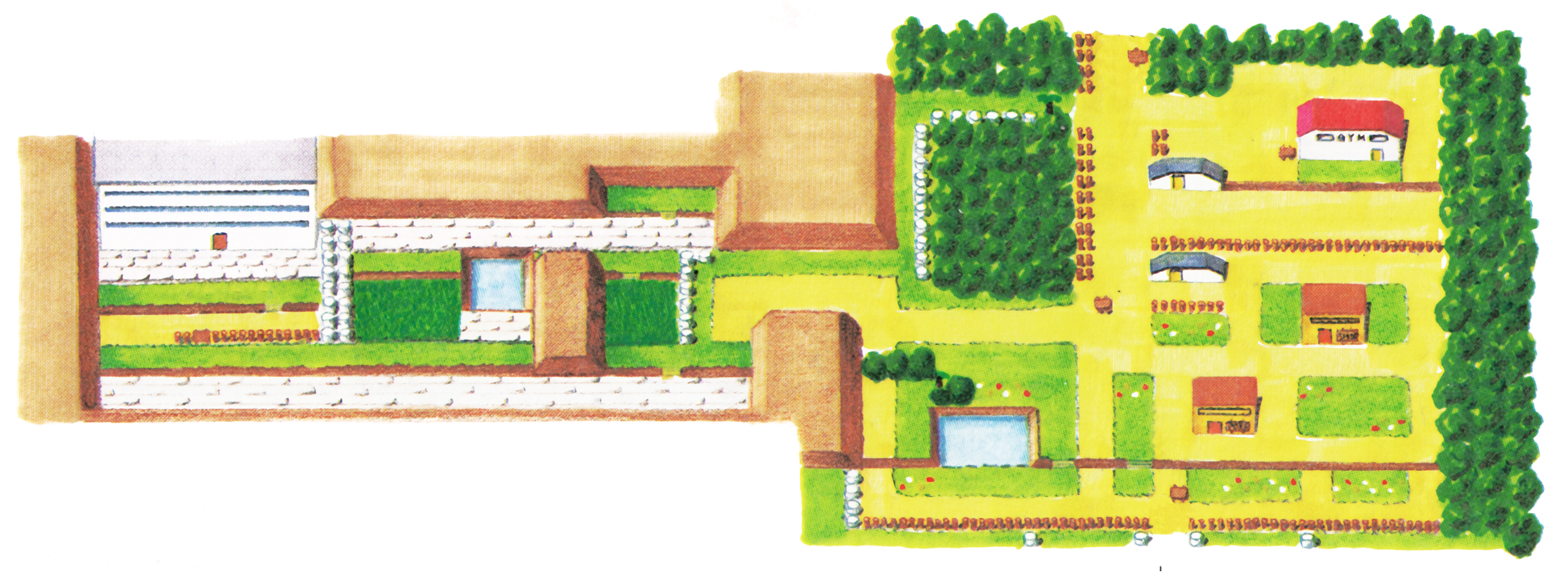
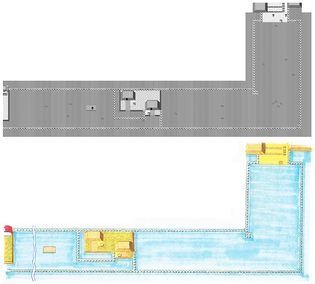
Route 6, Vermilion City, Route 11
Route 2
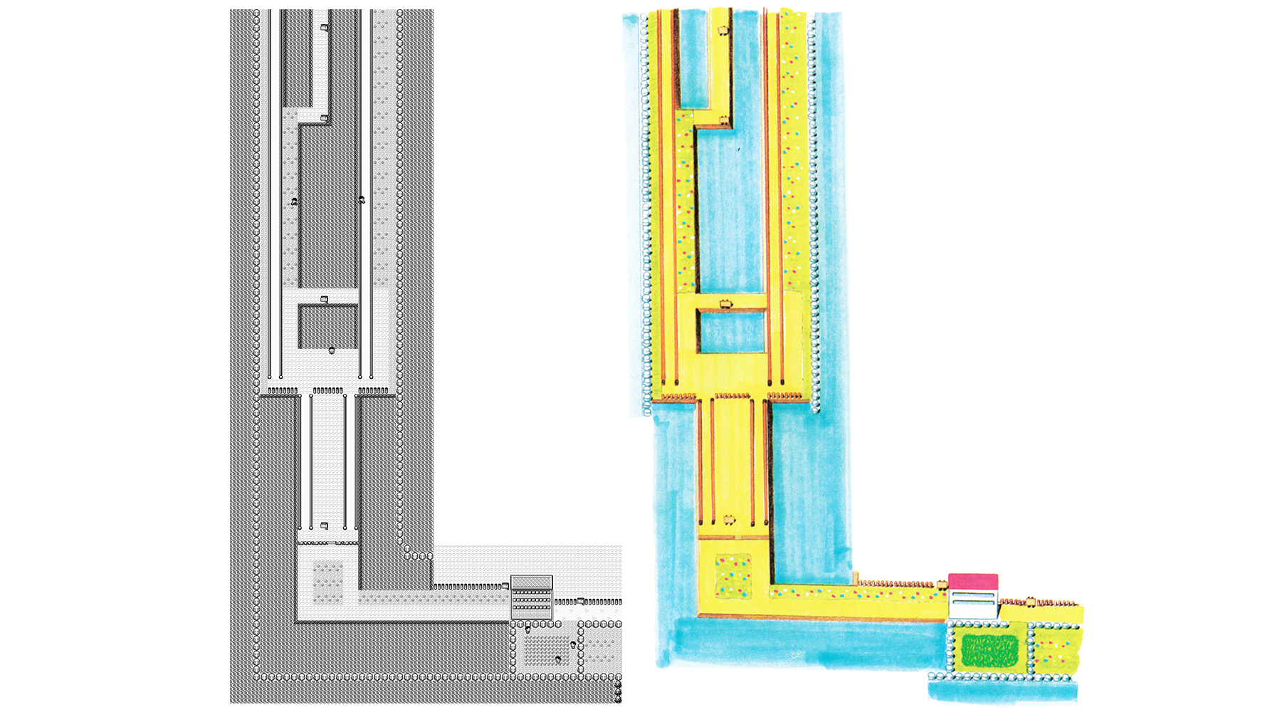
Routes 9 and 10
Route 10
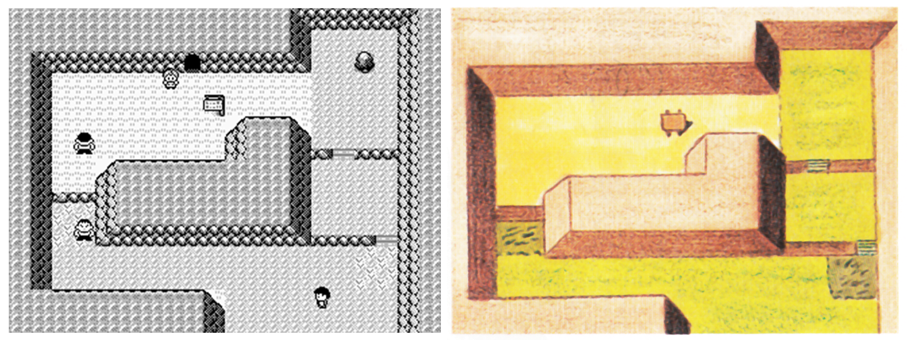
Dr Lava notes: In case you don’t recognize it, this is the small area just north of Lavender Town. The Hiker with his back turned is high on magic mushrooms in the Japanese version, but in the English version, the reason for his out-of-control laughter was changed to hay fever.
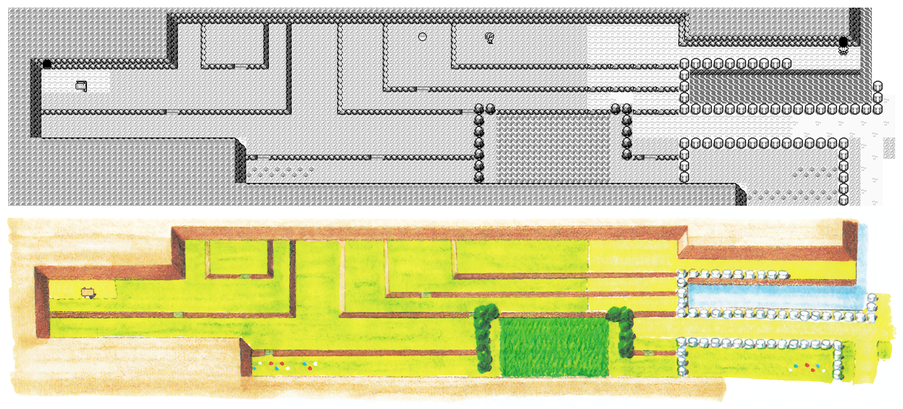
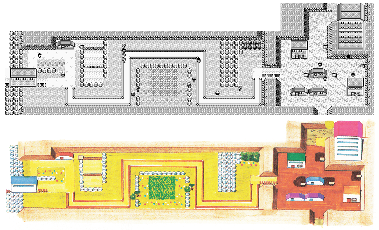
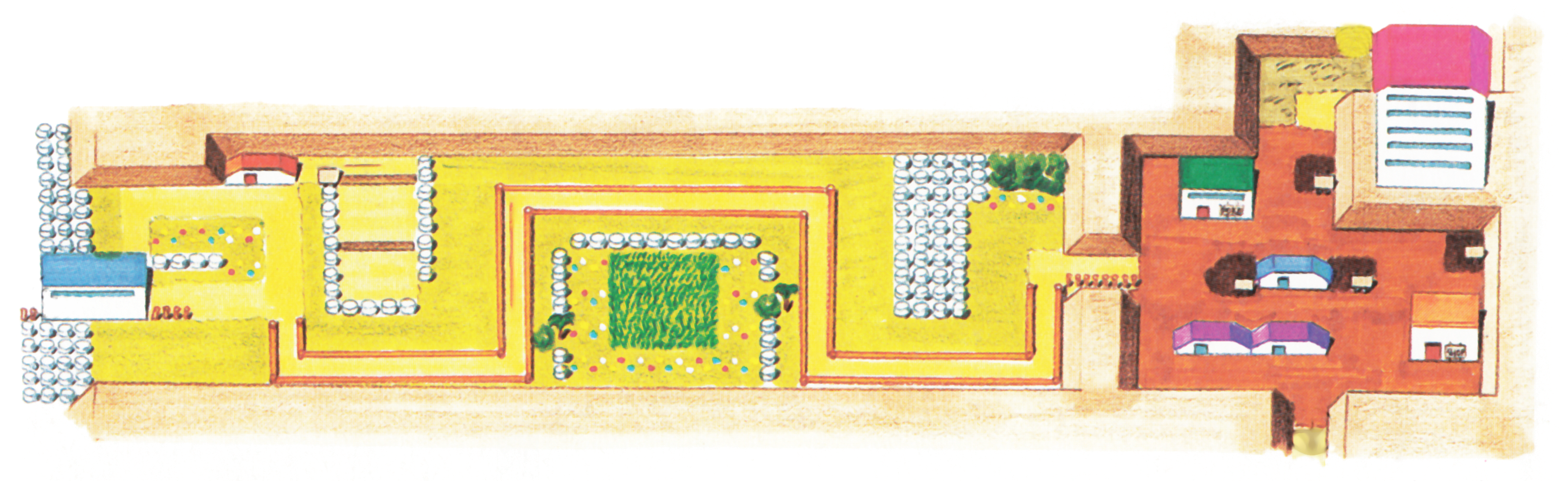
Lavender Town and Route 8
Dr Lava notes: At this point, you might be thinking, “Wow, imagine a Gen 1 remake in this art style. All of Kanto in watercolor!” Yup, that would be beautiful. Although now that we’ve already had two pairs of Gen 1 remakes (FRLG and LGPE), our chances of a seeing third anytime soon are pretty unlikely. But if any romhackers are reading this right now, feel free to take these watercolor maps and use them in a fangame.
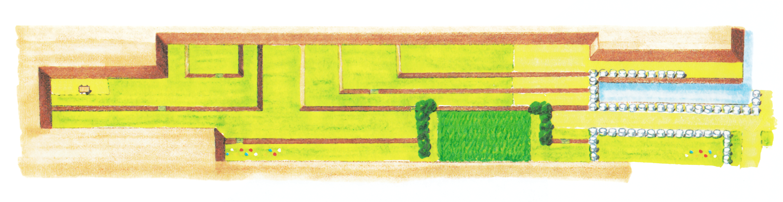
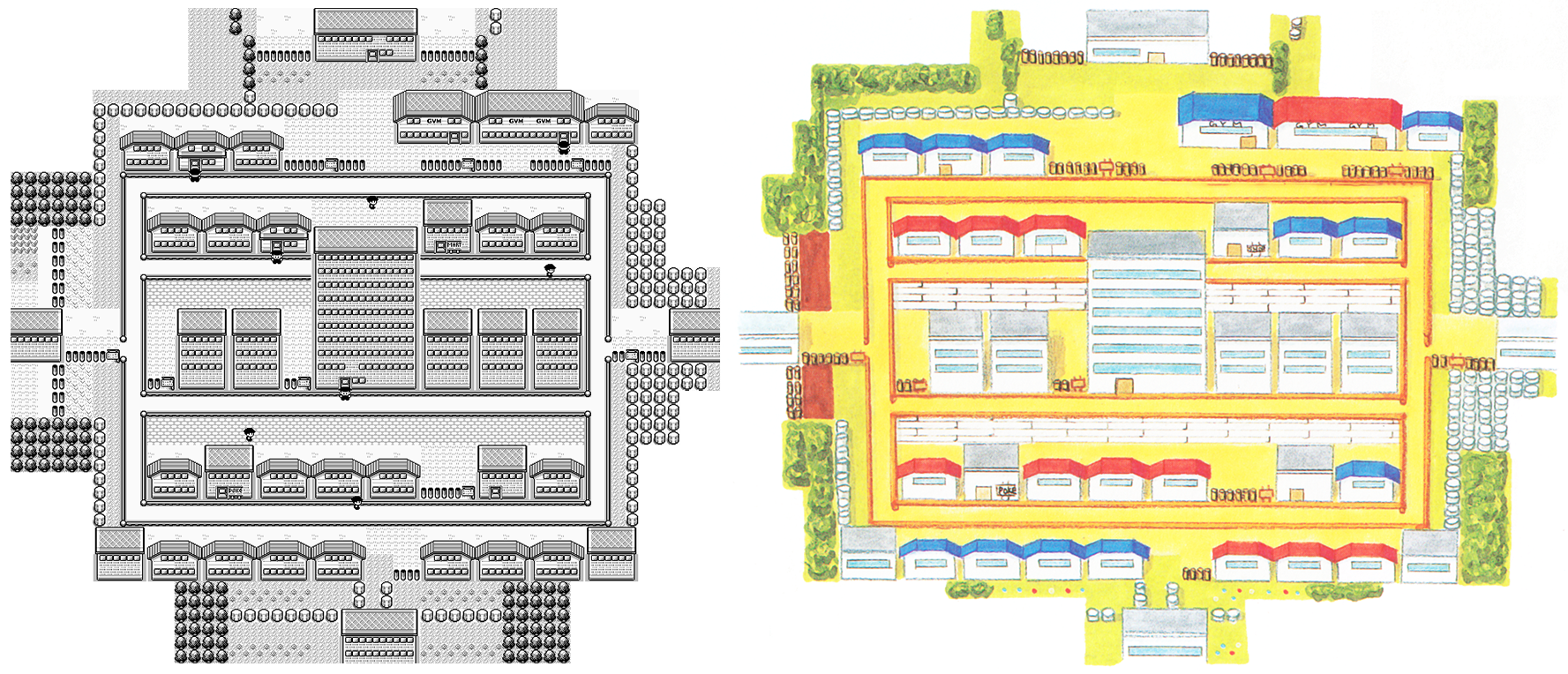
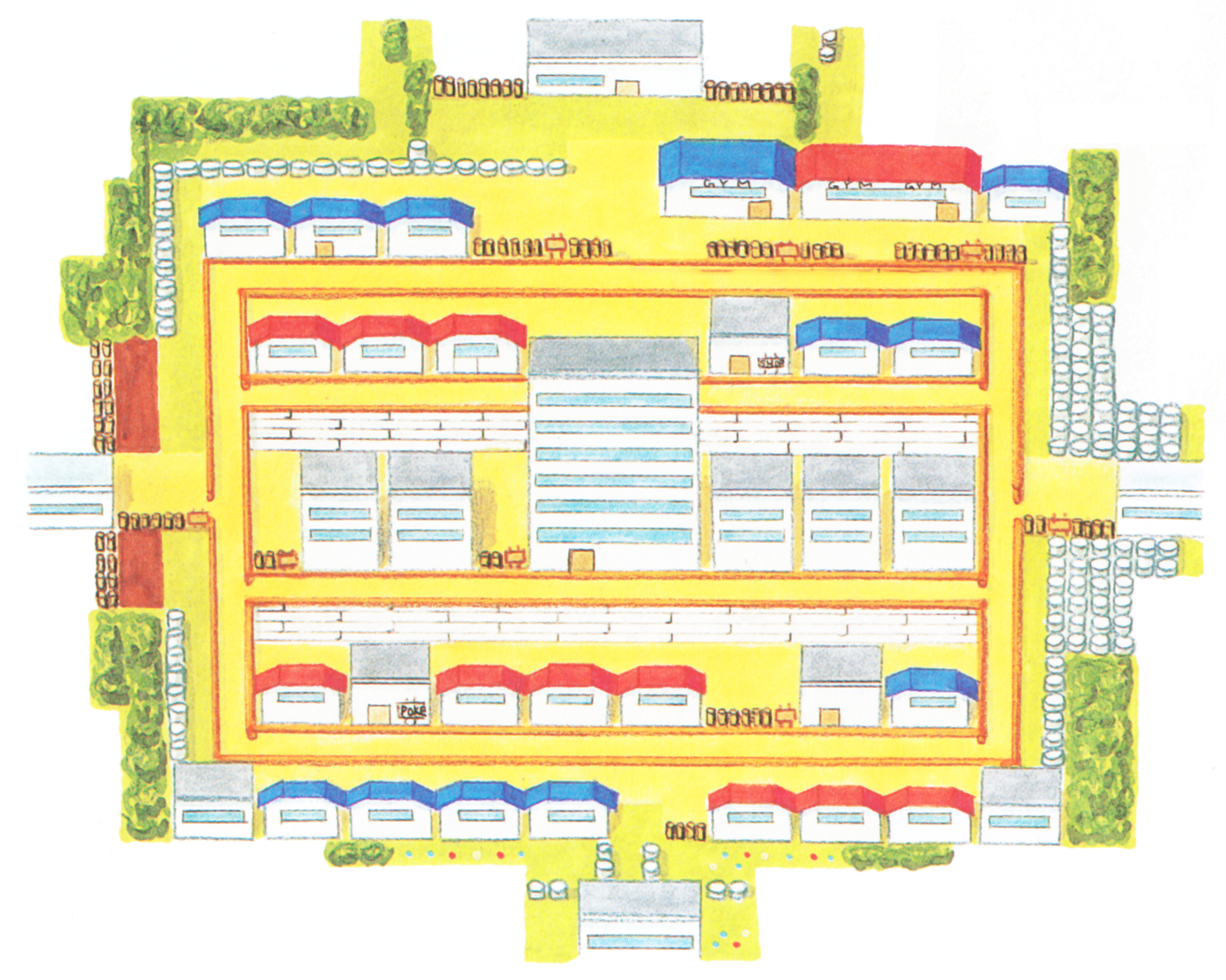
Route 7 and Celadon City
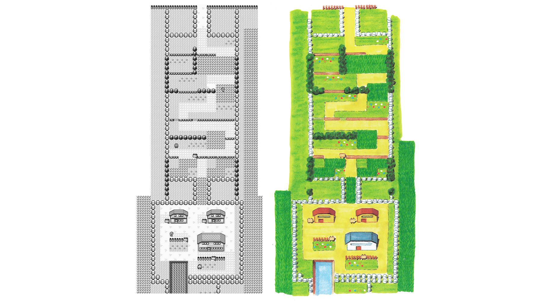
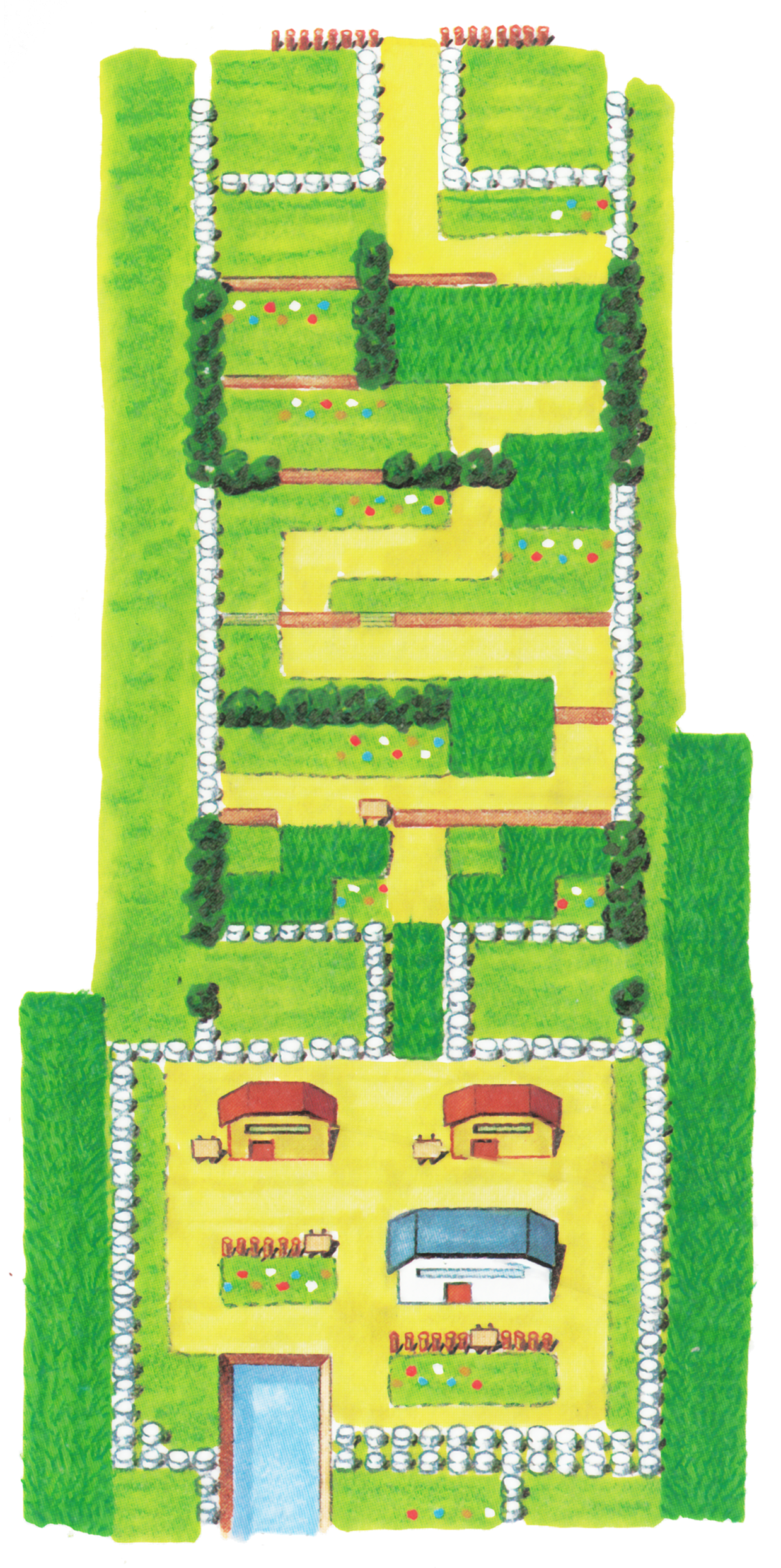
Route 17 (Cycling Road)
Routes 17 and 18
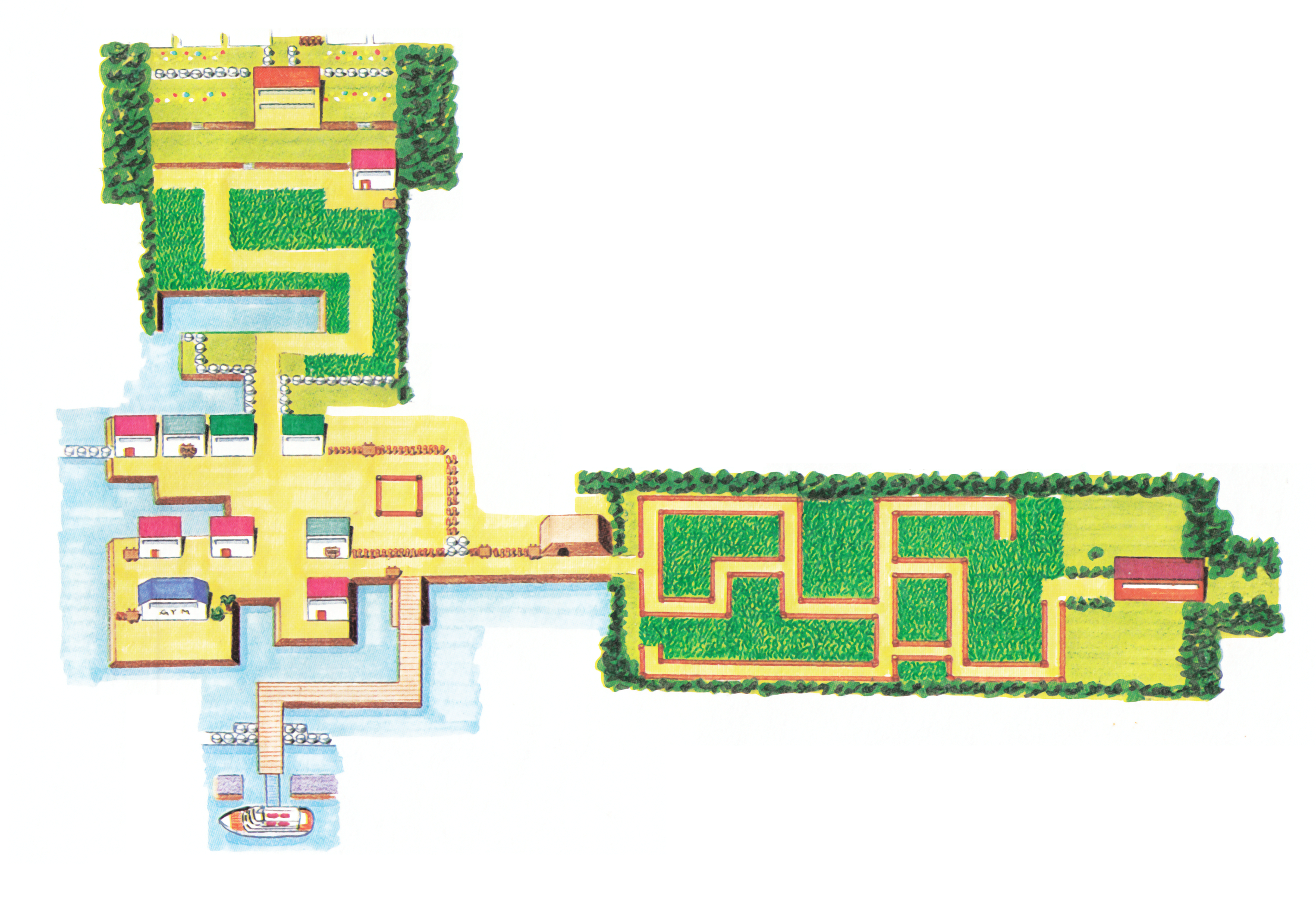
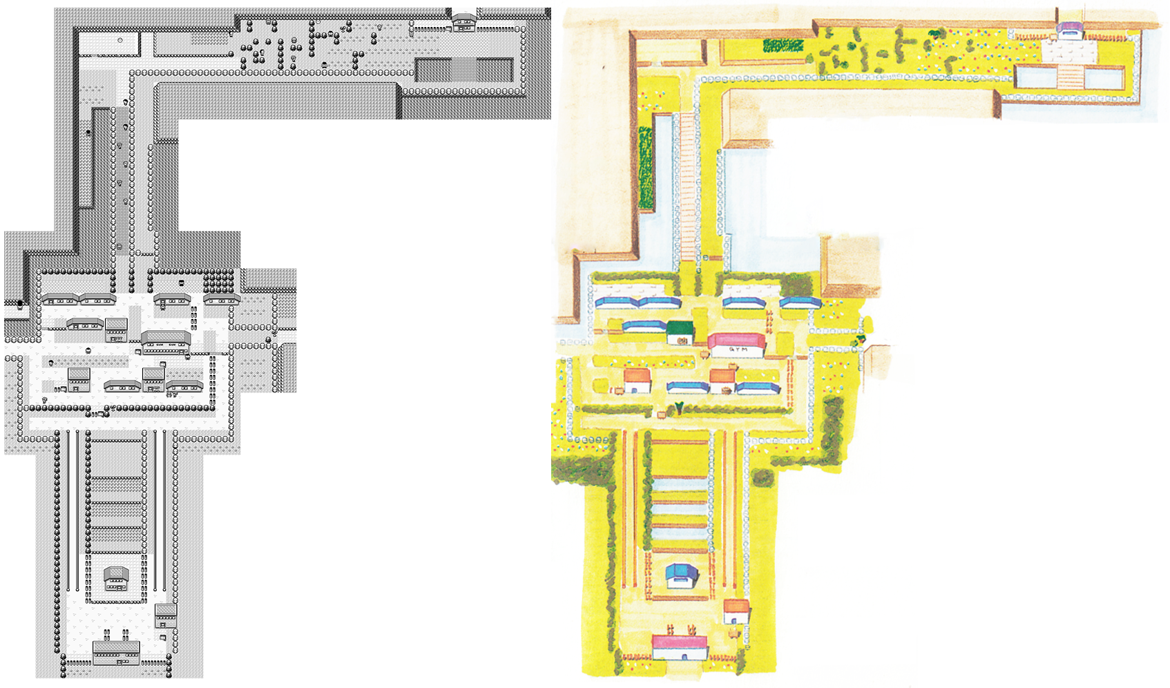
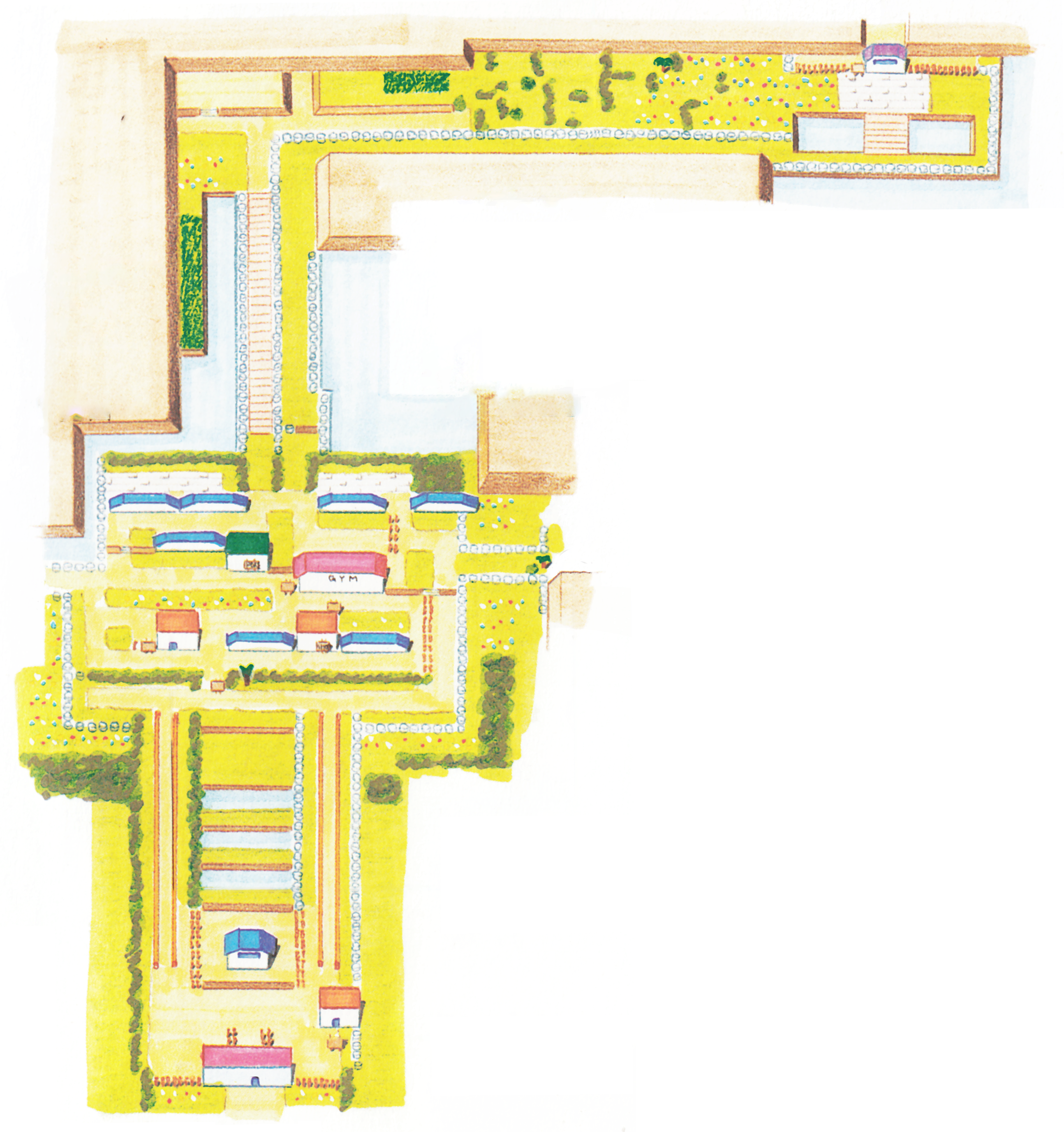
Fuchsia City

Safari Zone
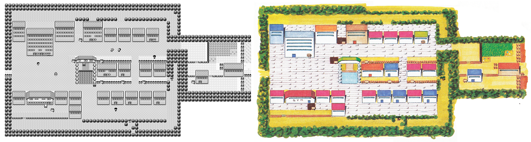
Saffron City
Route 12
Route 13
Routes 14 and 15
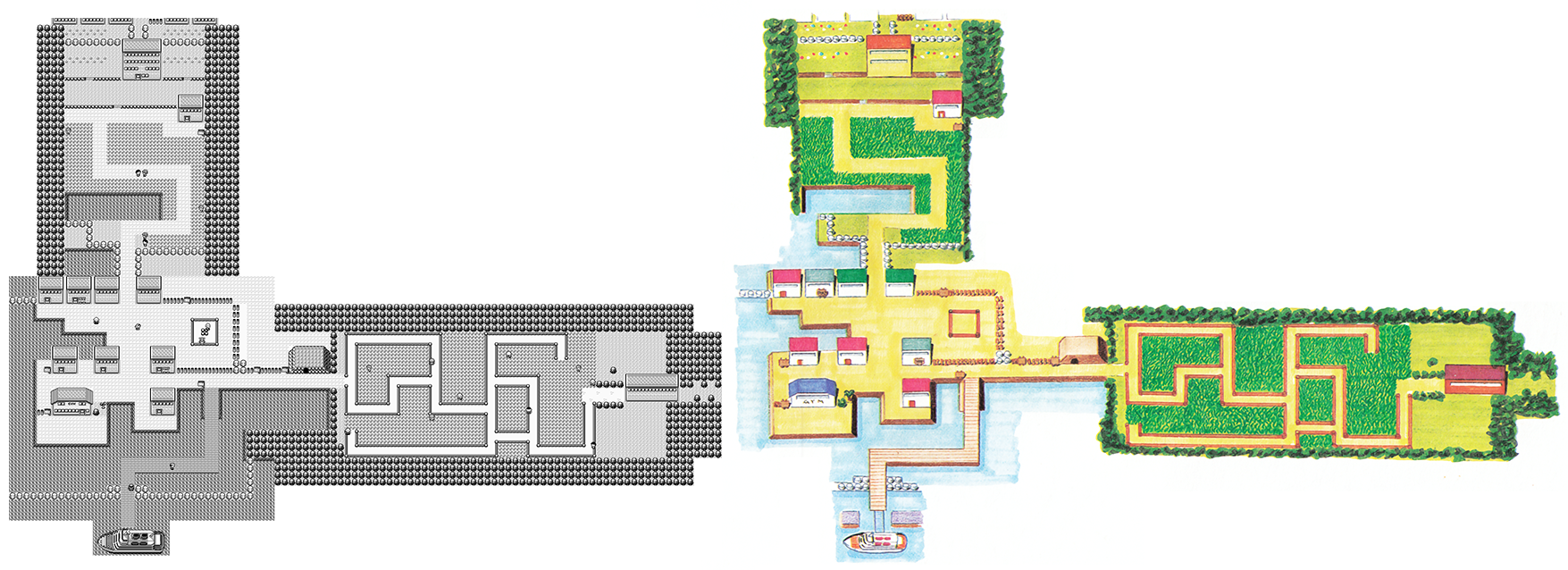
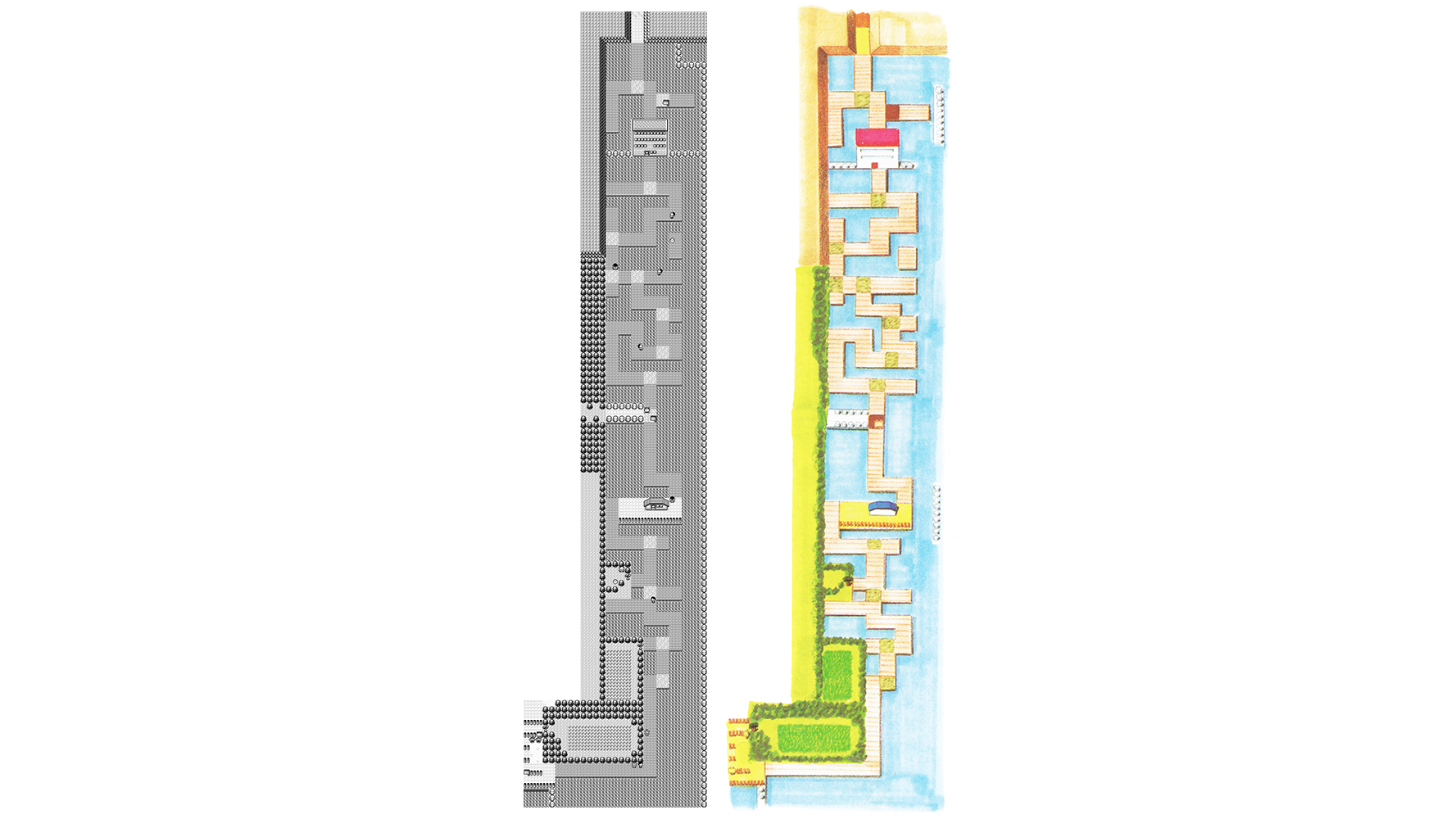
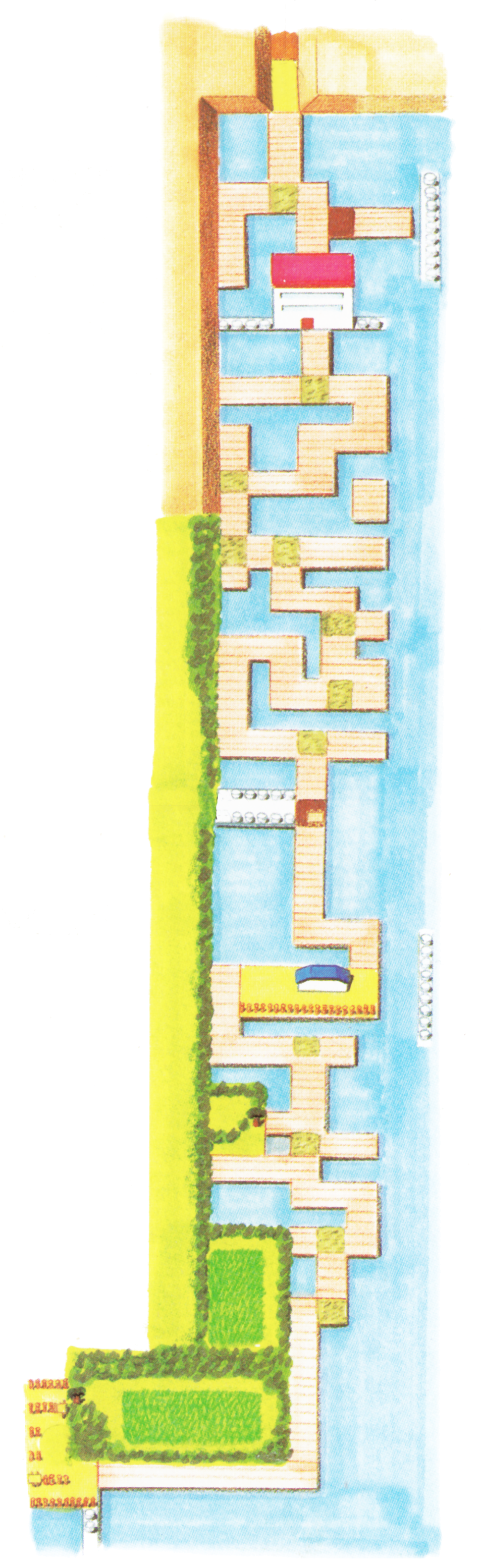
Route 19, Seafoam Islands, and Route 20
Route 21 and Cinnabar Island
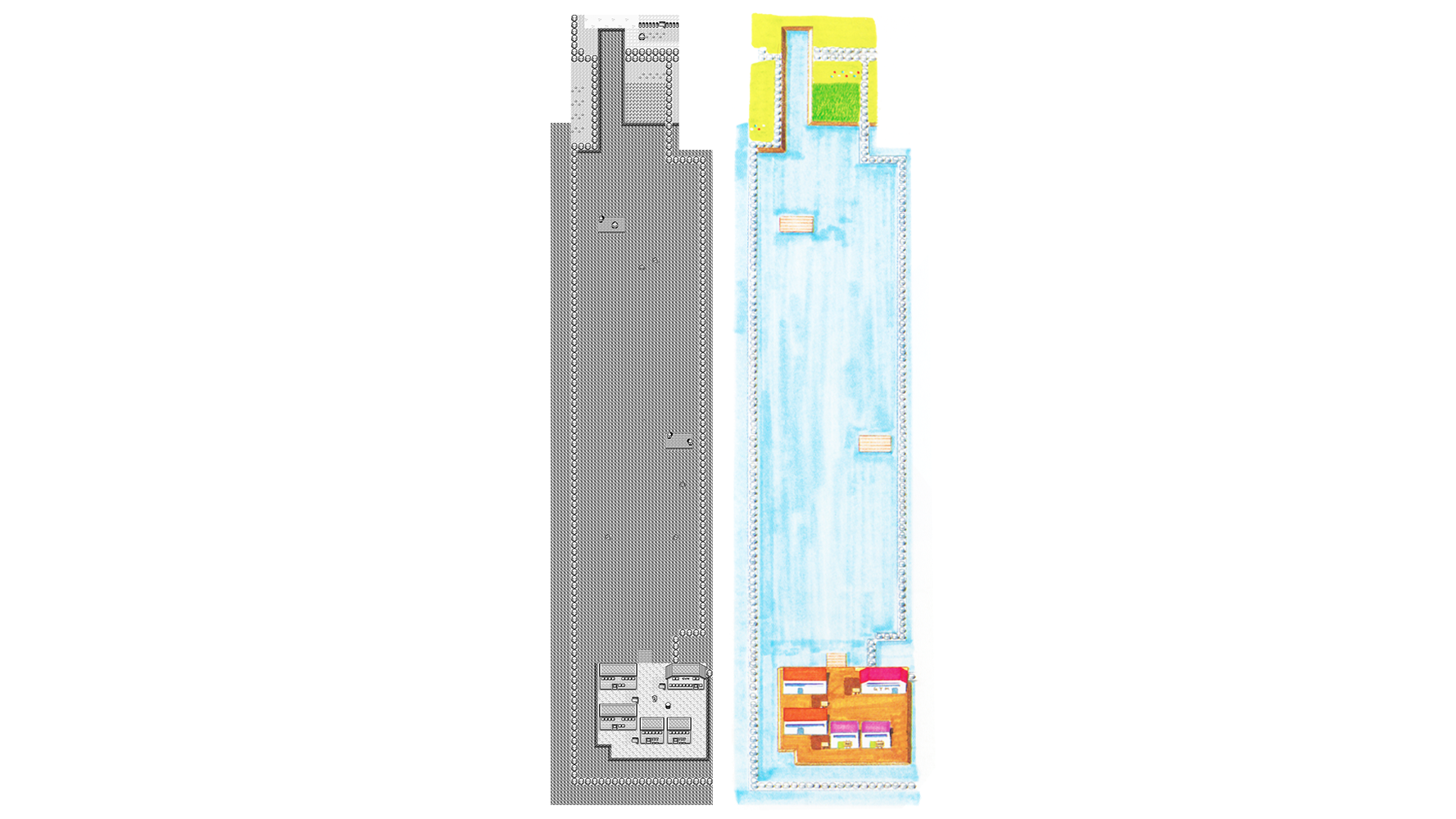
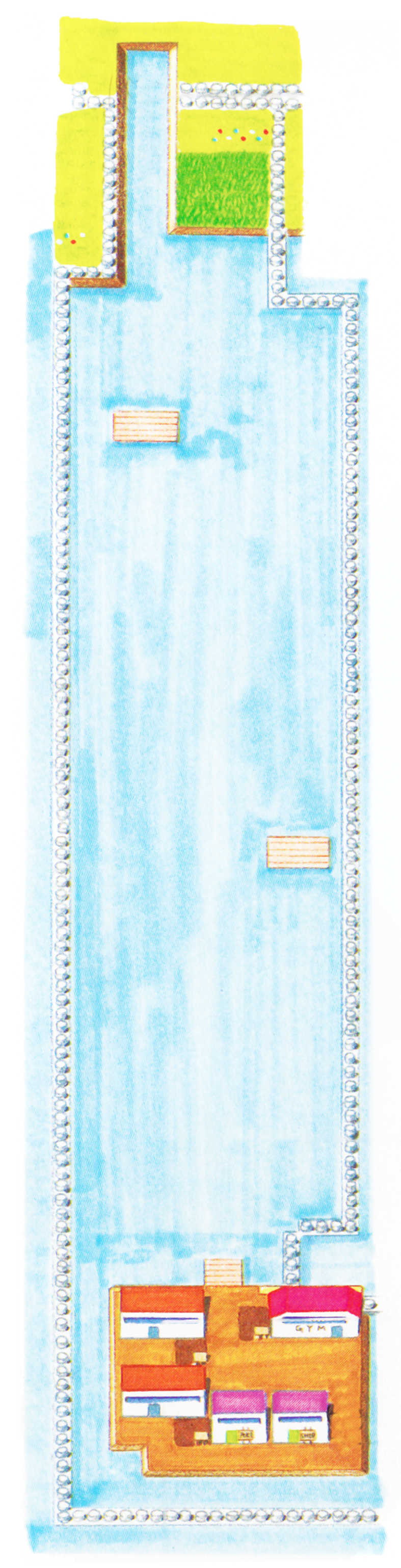
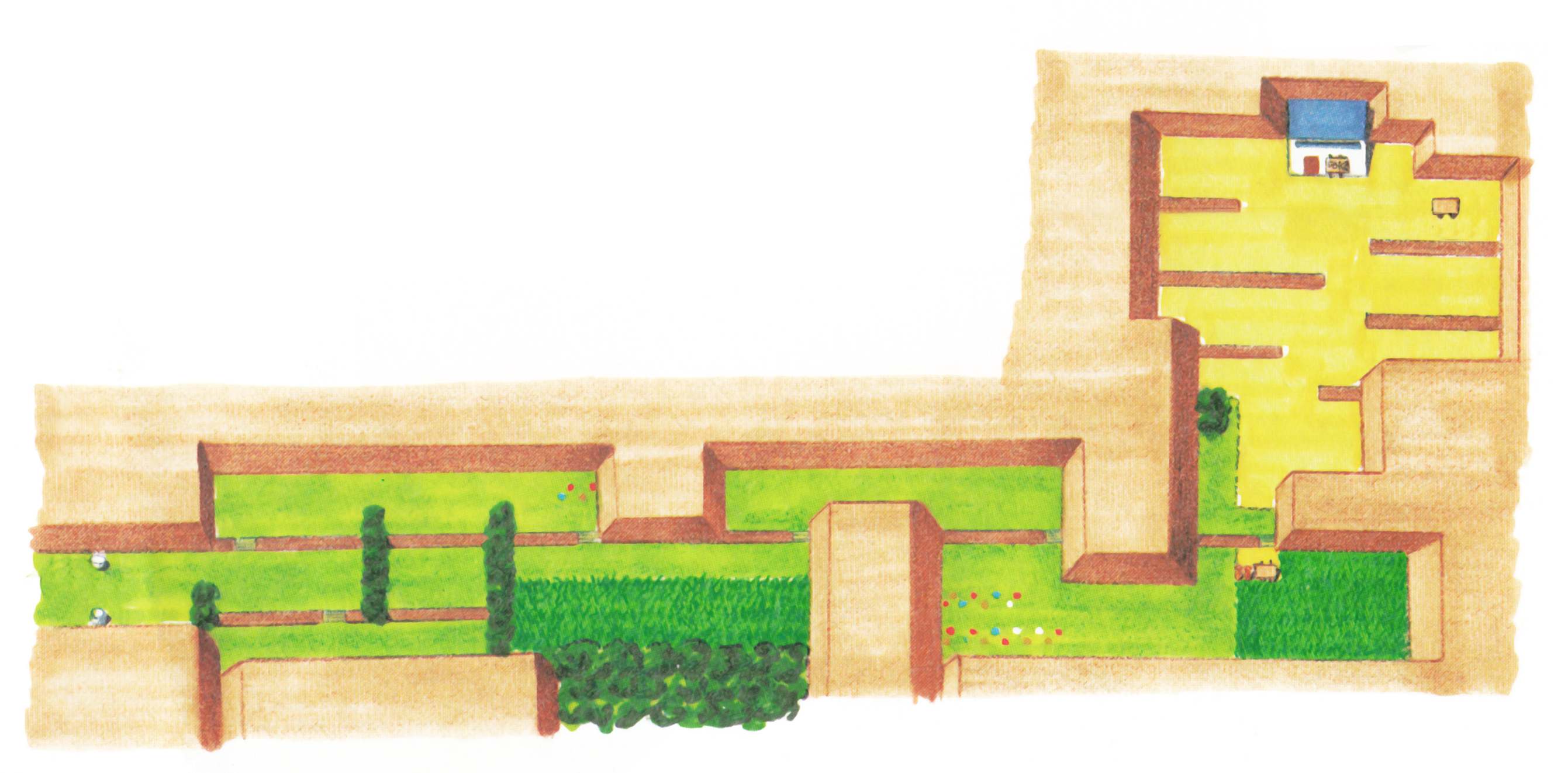
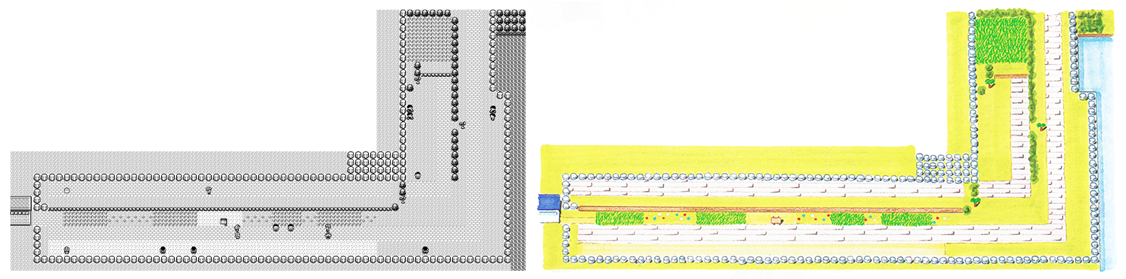
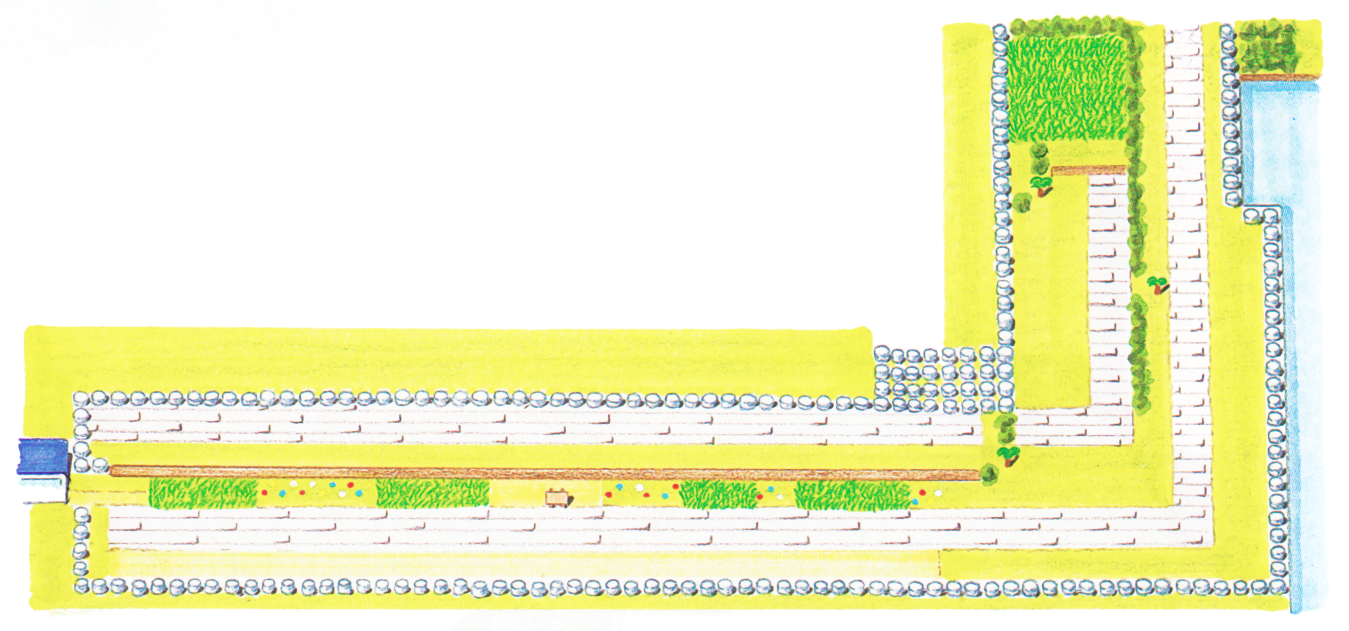
Route 10
Dr Lava notes: This one covers some of the same ground as an earlier map, but brings us back again as the guide instructs the player to make their way to the Power Plant.
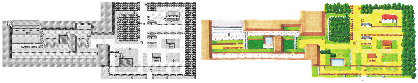
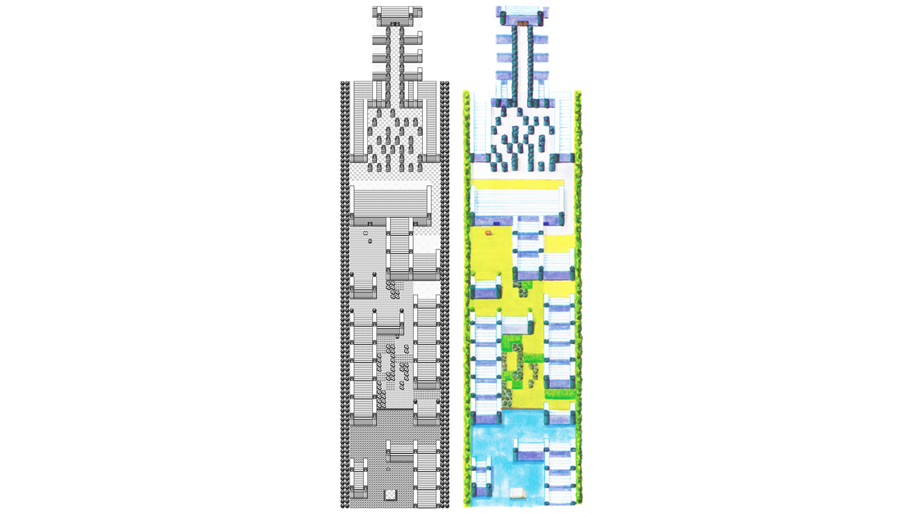
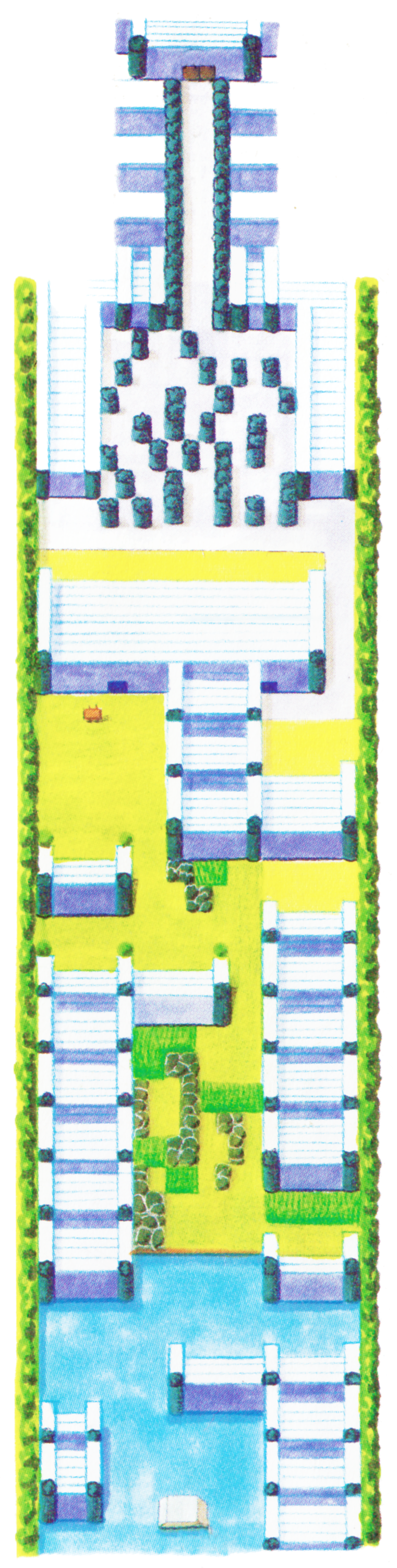
Route 23
Route 23 Indigo Plateau
Closing Comments
Huge thanks to my friend HiResPokemon for these enhanced scans — check him out if you wanna see lots more rare Pokemon artwork. For updates on this 1996 book’s translation, plus various other projects currently in progress, follow me on Twitter or Instagram where I’m DrLavaYT. There’s plenty more translations already available on this website’s homepage, and I’ll link to some of the best ones down below. Thanks for reading 🙂
Read More Pokemon Translations:
• Interview: Sugimori and Masuda on Gen 1’s Development (2000)
• Interview: Tajiri and Ishihara on Pokemon’s Beginnings (2000)
• Developer Blog: 90’s Pokemon Anime Was Written Under the Influence (2009)
Videos About Pokemon History:
• Translation: Sugimori Explains Gen 5 Beta Pokemon
• Cut Content: Gen 4 and 5’s Scrapped Lock Capsule Event
• Cut Content: Gen 4’s Internal Data and Cut Content